
Tropical Cyclone Oma has continued to move slowly southwest overnight. Models are coming into better agreement about the future track of Oma. The cyclone is expected to move closer to the QLD coast in the next day or two followed by a turn to the northwest. A direct landfall is not likely. However, Oma will certainly move close enough to lash the coast with strong winds and heavy rains. Starting as early as tonight, these hazards could persist well into next week.
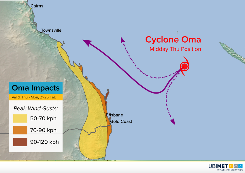
Oma is now a category two cyclone. Relatively cool water temperatures along the path of the storm are likely to lead to gradual weakening. Oma could even become a subtropical or hybrid storm system. However, the storm’s large wind radius will mean a long stretch of the Australian coast could be in for significant wind gusts (see map above). These will be increasing tonight even with the cyclone still well out to sea. The strongest wind gusts up to 120 kph will impact outlying islands and exposed capes like Moreton Island and Fraser Island. A larger stretch including Brisbane metro and the Gold Coast will see gusts more like 70-90 kph.
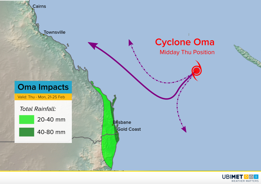
Heavy, flooding rainfall will not be a widespread threat as long as the system remains somewhat offshore. However, outer bands could rake the immediate coast and islands with rainfall of 40-80 mm, enough to produce some minor, localized flooding (see map above). Elevated tides and high waves will contribute to the flooding danger in low-lying beach communities. Of course, a closer track to the coast would mean an increased risk of wind and flood damage. Oma will continue to be monitored closely. Lead photo courtesy flickr user Amy McGovern.