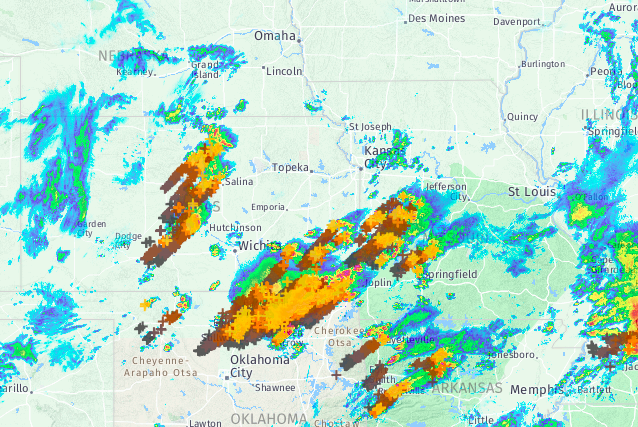
You might expect to see a radar/lightning map like the one below in April or May in the Plains. Numerous storms are moving through the the corridor from Kansas and Oklahoma into Missouri and Arkansas. Some of these storms are strong to severe, even tornado-capable in isolated cases. However, thanks to a strong Arctic air mass draped across the area, the most widespread and dangerous hazard into Thursday will be ice accumulation.
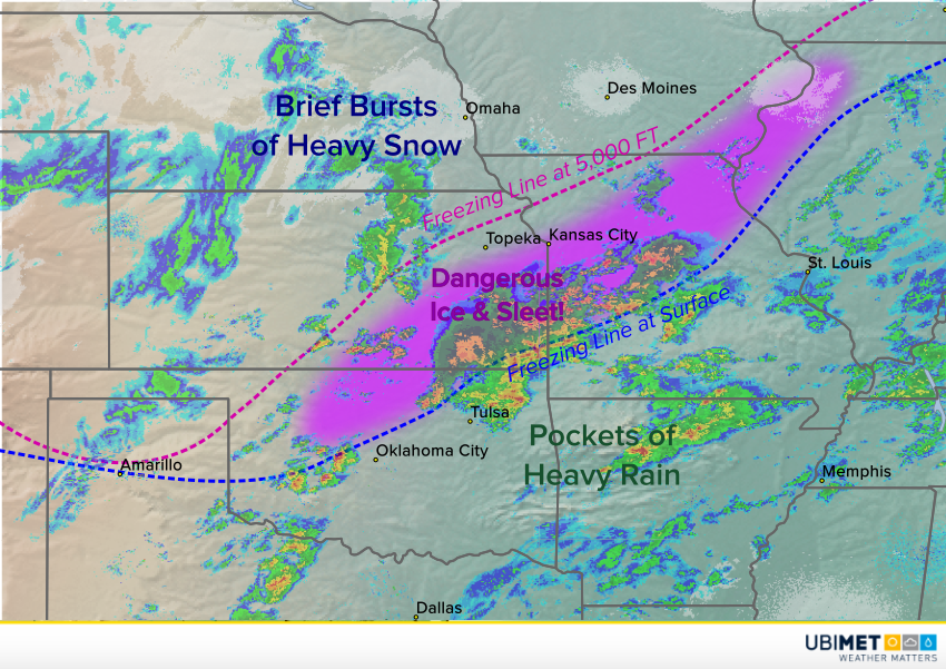
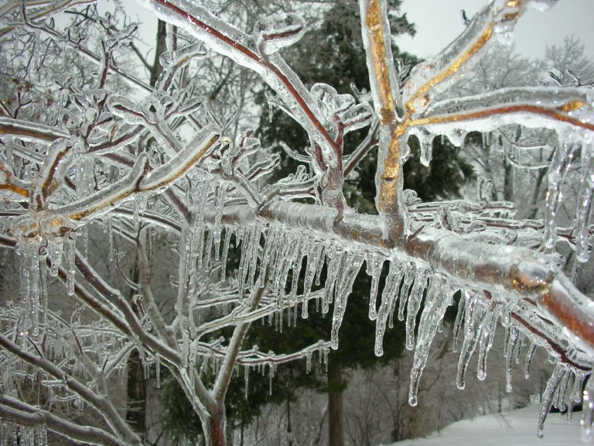
The Arctic air mass that has creeped south into the Central Plains is very shallow. Not far above the surface, temperatures are much warmer, well above freezing. The map below shows the freezing line not only at the surface (in blue) but at 5,000 feet (in purple). In between these lines, rain is falling into surface temperatures below freezing, in some areas well below freezing in the teens and lower 20s. The rain is thus freezing at it reaches the surface, creating a dangerous glaze of ice. Some locations within the pink shading will see ice accumulation up to 0.5 inch through midday Thursday. Travel will be quite dangerous and should be avoided if at all possible. Scattered power outages will also be a threat as ice-laden tree branches and power lines come down. Lead photo courtesy flickr contributor Alan Light.