A powerful winter storm raked areas of the Plains, Great Lakes, and Northeast late last week into the weekend. Snowfall up to 30 inches ( cm) was accompanied by wind gusts up to 50 mph (80 kph), leading to dangerous blizzard conditions. The coldest air of the season has invaded the eastern U.S. in the storm’s wake.
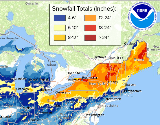
The map above shows snow accumulations from Friday through Monday (19-21 January). The heaviest totals exceeding 18 inches (45 cm) were recorded from central New York through the mountains of interior New England to eastern Maine. Widespread totals of 12-18 inches (30-45 cm) were reported all the way back into northeastern Ohio and as far south as Albany. Accumulations of 8-12 inches (20-30 cm) affected northern Pennsylvania and the northwestern suburbs of Boston.
To the south, snow mixed with sleet and freezing rain (not shown on map above). Icing totals of 0.25-0.5 inch (6-12 mm) occurred over portions of northeastern Pennsylvania, southern New York, and southern New England just inland from the coast. The icing and winds combined to knock down branches and power lines, resulting in numerous power outages.
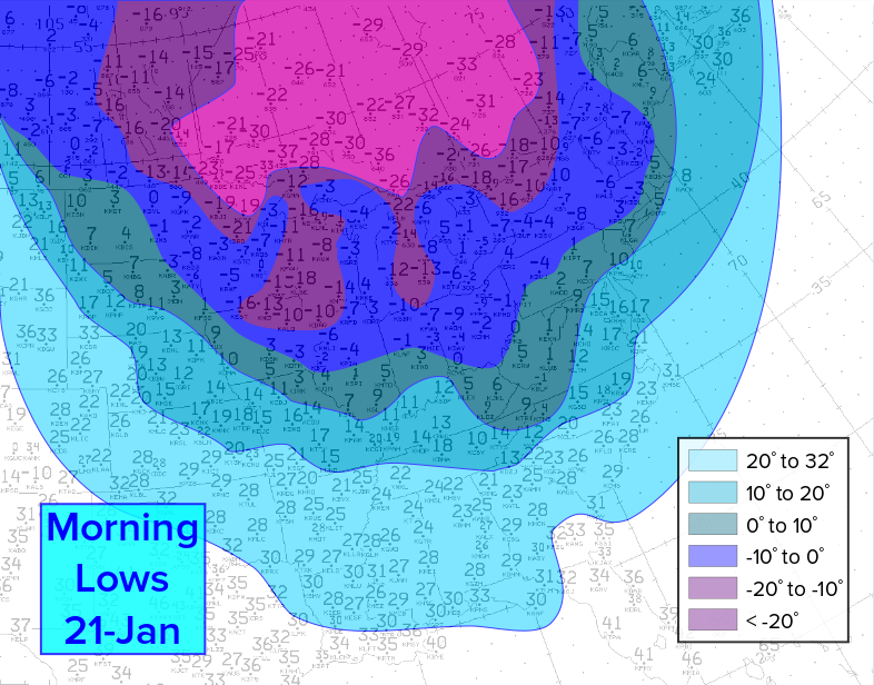
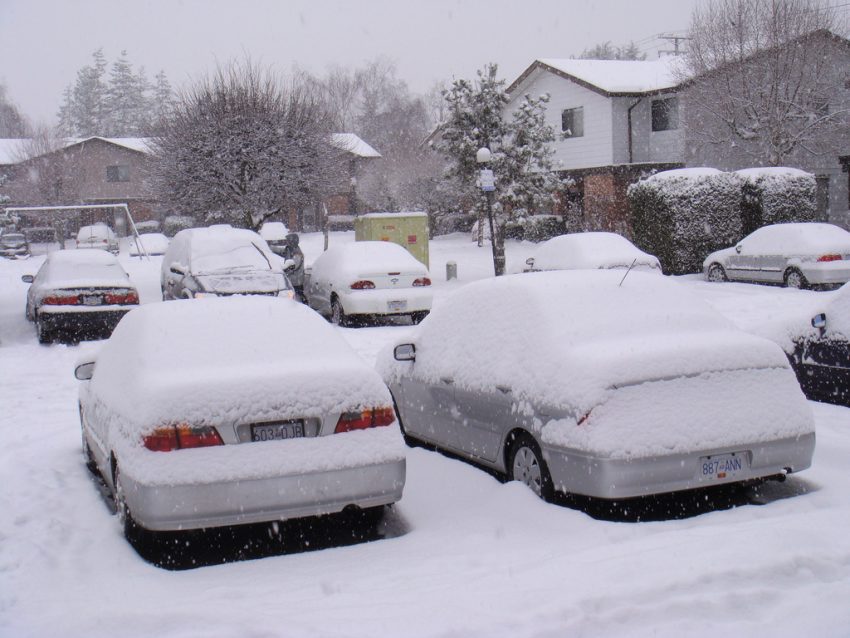
The storm ushered in a frigid Arctic air mass, resulting in the coldest temperatures of the season (see map above for Monday morning lows). Gusty northwest winds persisted through Sunday night and Monday behind the departing storm. Wind chills plummeted well below zero deg F for many areas, even as far south as the major coastal cities. Fortunately, conditions should improve rapidly this week. Lead photo courtesy flickr user Thomas Chung.