
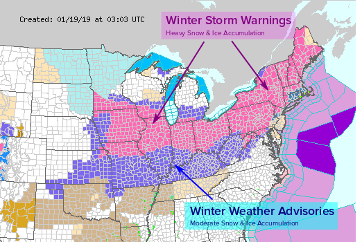
Winter storm warnings and advisories are in effect across the Midwest and Northeast U.S. (see map below). A major winter storm is swirling across the Plains tonight. It will spread heavy winter precipitation across the Midwest and Northeast from Saturday into Sunday. Crippling snow and ice will affect millions of residents across these regions this weekend!
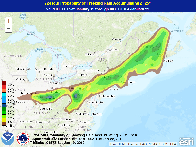
Two systems are coming together to form one major winter cyclone that will move from the central Appalachians to the Northeast coast and off of Maritime Canada by Monday morning. Precipitation will start as all snow across the region initially. Warm air will surge into the coast, however, by early Sunday morning. Snow will change to rain for the immediate coast, cutting into wintry precipitation totals for cities like New York. However, the northern suburbs will see a nasty mix of freezing rain, sleet, and snow. The graphic below shows the probability of icing over 0.25 inch (6 mm).
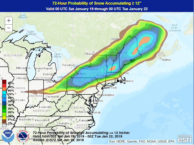
For areas a bit further inland, precipitation will remain mostly or all snow. As you can see from the map below, there is a large area of the interior Northeast very likely to see accumulations in excess of a foot (30 cm). Some spots in the mountains could see totals of 24-30 inches (60-75 cm)! The heavy snow will be accompanied by gusty winds, leading to dangerous blizzard conditions with near-zero visibilities and drifts of several feet.
This winter storm is on the leading edge of frigid Arctic air, the coldest air of the season by far. Morning lows on Monday will be below zero over much of the Northeast. Gusty winds will continue, leading to life-threatening wind chills of -15 to -30 deg F. Forecast graphics included in this article come courtesy of the hard-working meteorologists of the NWS and WPC.