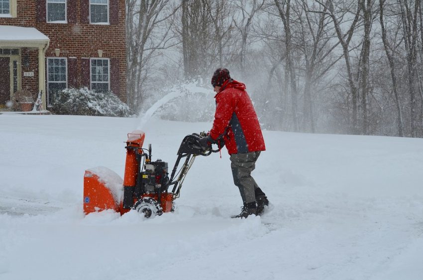
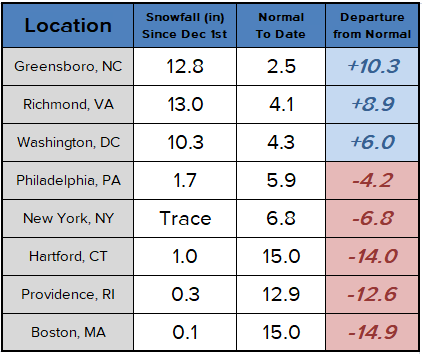
For snow lovers in the coastal Northeast U.S. it was a dismal holiday season. Portions of the South and Mid-Atlantic have seen plenty of the white stuff. However, the major cities along the Urban Corridor have seen little to no snow since December 1st (see table below). A major shift in the weather pattern should bring an end to the snow drought, however, starting as early as this weekend.
The upper air flow across much of the U.S. in the past 6+ weeks has been fairly zonal. There have been storm systems and plenty of rain with some snow in the mountains. However, intrusions of Arctic air have been mostly bottled up in northern Canada. Temperatures have settled down into winter-like ranges the past several days, though. Meanwhile, a more amplified jet stream pattern looks to develop later this week, often a favorable setup for snowy “Nor’Easter” storms.
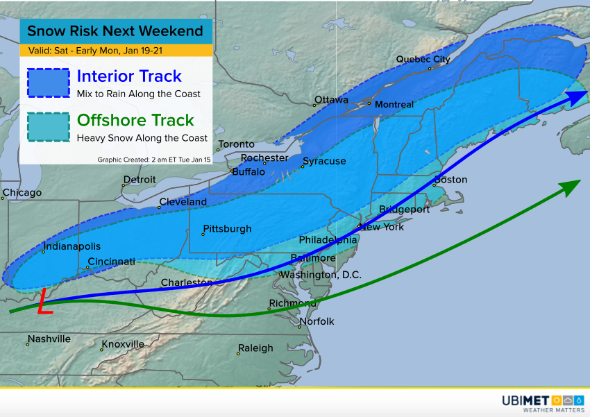
The latest model guidance suggests a potent storm system will ride along a strong cold front late this week into the weekend. Significant snows could affect portions of the Midwest, the central Appalachians, and the Northeast. Which locations see how much snowfall will depend on the track and strength of the low pressure system (see map above). A stronger and/or southerly storm will mean colder air along the coast and a major snow storm! However, a more northerly and/or weaker storm will bring warmer air into the cities. In that circumstance, a wintry mix could change to rain overnight Saturday into Sunday morning. Right now the trends point to the warmer/rainier scenario. Heavy snows would threaten the interior mountains, however the Urban Corridor would be largely spared. A lot could change in the next several days, though, so play close attention to your local forecasts!