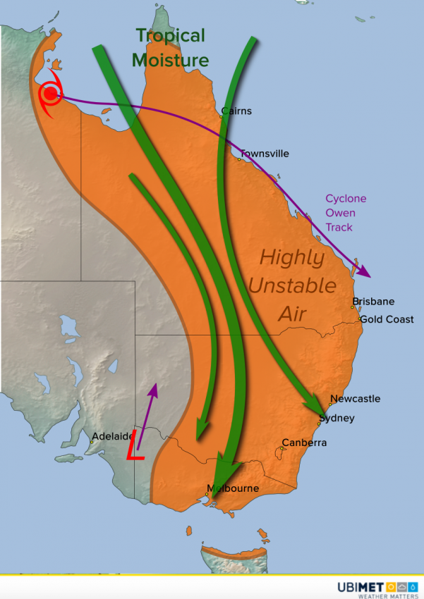
The combination of Tropical Cyclone Owen and a powerful upper low over the southeast has tapped into rich tropical moisture. This moisture has invaded much of eastern Australia, sparking widespread storm development. Flooding rains will continue to inundate many areas through the weekend.
Cyclone Owen continues to loiter over the southwest Gulf of Carpentaria. Meanwhile, an upper low has moved into the interior southeast. Strong northerly flow to the west of these systems is pulling tropical moisture from the Coral Sea south. This moisture is helping feed numerous storms across Queensland, New South Wales, and Victoria. The strongest storms have mostly been over the interior so far where the best combination of tropical moisture and heat resides. You can see on the map below the concentration of lightning activity early Thursday afternoon over the interior. Lightning strike frequency is climbing past 120 strokes per minute!
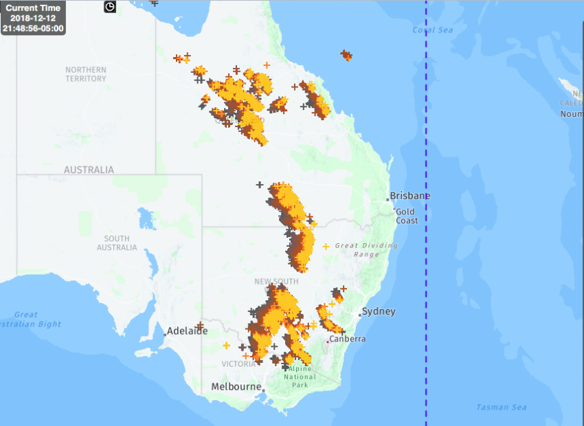
Although locally damaging winds are a threat, the most common danger with these storms is torrential rainfall and flash flooding. Some of the heaviest amounts so far have been reported in the Alps of eastern Victoria, with rates exceeding 50 mm/hr. Our models suggest this long-ranging squall line will approach the NSW coast later this afternoon or evening, including Sydney and Newcastle.