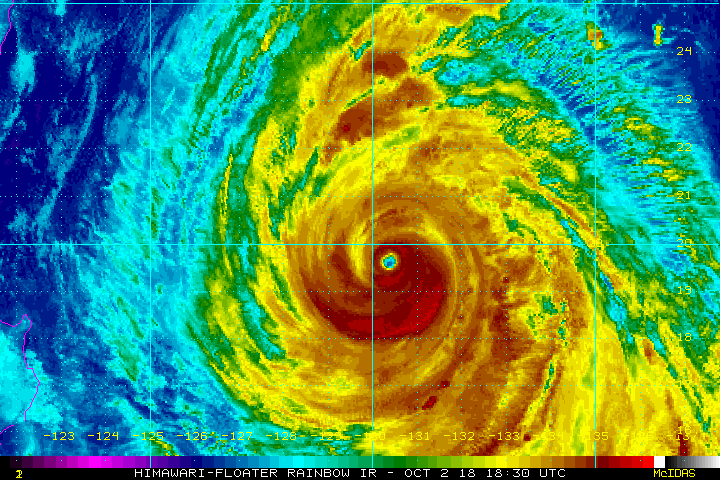
Powerful Super Typhoon Kong-Rey is a category four cyclone today east of Taiwan with sustained winds up to 120 mph (195 kph). Like several other storms this season, Kong-Rey will be moving through the Ryukyu Islands in the next day. The next target looks to be either southern Japan or the Korean Peninsula. Model guidance generally suggests Korea is more likely this weekend.
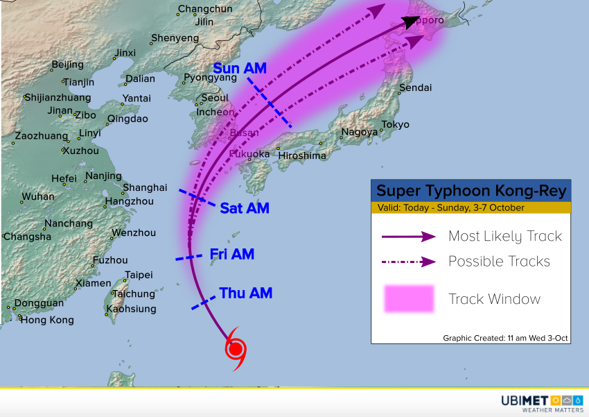
Kong-Rey is moving into an area of cooler sea surface temperatures. Although it’s a well-organized cyclone, the cooler waters will cause weakening over the next few days. However, it will still be a major weather maker for South Korea and Japan. The latest model guidance is in good agreement about a track that would clip the southern tip of the Korean Peninsula later Saturday through Sunday morning.
The heaviest rains and damaging winds would likely impact South Korea in this scenario. Kong-Rey will be picking up speed, but will still drop upwards of 12 inches (300 mm) of rain near and north of the cyclone’s path. Locally heavier amounts could fall in the mountains, leading to serious flash flooding and mudslides! A dangerous storm surge could also impact the south coast of Korea, depending on the exact track.