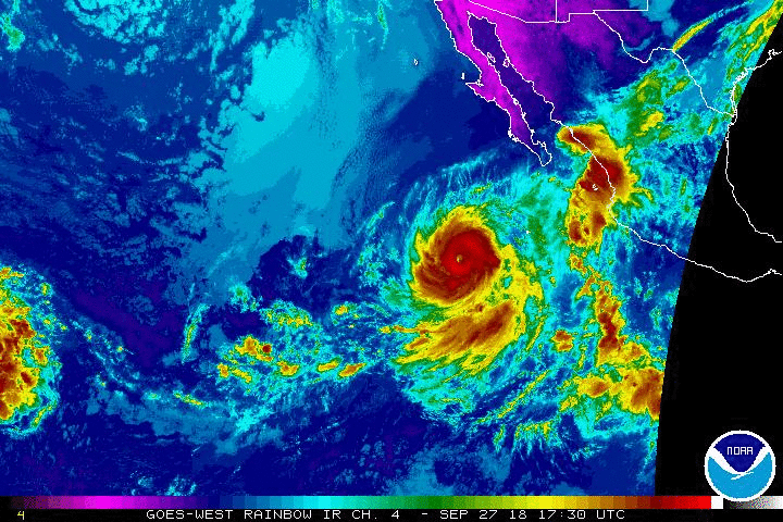
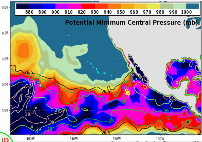
Hurricane Rosa underwent rapid intensification early today and is now a category four cyclone. Rosa is moving slowly west and will encounter much cooler sea surface temperatures in the next few days (see map below), so weakening is likely. However, Rosa will also be speeding up and turning north, then northeast. Rosa will threaten portions of northwest Mexico and the American Southwest later this weekend into early next week.
Most of the models suggest Rosa will make an initial landfall along the northern Baja Californian coast. By then, Rosa will have weakened significantly thanks to much cooler water temperatures. However, increasing forward speed may carry it fast enough into the Desert Southwest that Rosa will retain some gusty wind potential, especially in the higher terrain near and east of the track of the circulation.
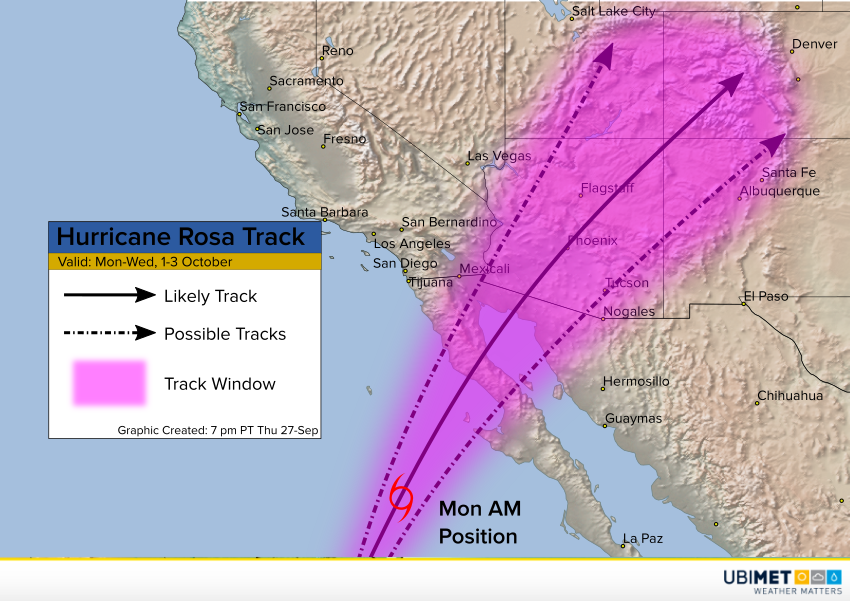
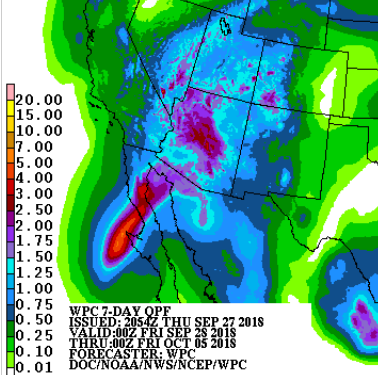
The most significant hazard, however, will likely be heavy, flooding rainfall over a region unaccustomed to the kinds of amounts in the forecast. Where the rain falls will depend on the exact track of this small but powerful storm. Most models carry the storm through central Arizona. In this corridor, expect widespread amounts of 1.5-3 inches (38-75 mm) in 12 hours or less. Localized amounts of 4-5 inches (100-125 mm) are likely. That kind of rainfall will easily overwhelm the local drainage capacity. Significant flooding will be the result!