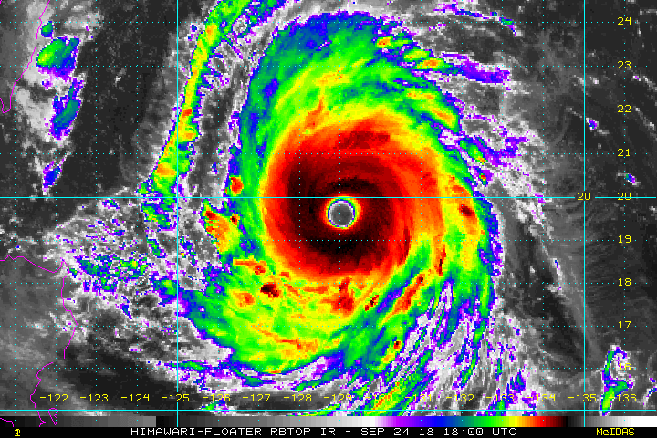
Super Typhoon Trami became the fourth category five cyclone of the 2018 Western Pacific season on Monday. Forward motion has slowed to westward crawl, however. Steering winds will remain quite weak over the next few days and Trami won’t pose an immediate threat to any major land masses. That could change as we head towards this weekend, however!
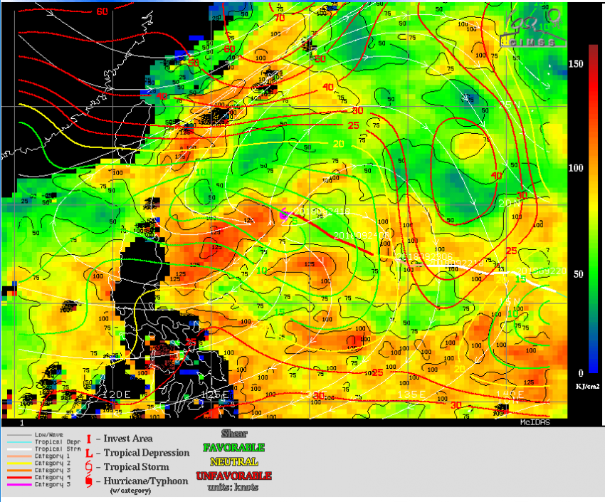
Trami will continue to move through a favorable environment over the next few days. Ocean waters lie beneath the storm with weak vertical wind shear above (see map above). These conditions will ensure that Trami remains a strong typhoon despite the slow storm motion that might otherwise lead to weakening.
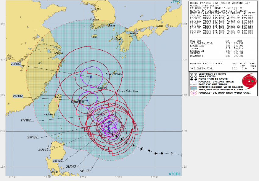
Trami is expected to drift slowly north to northwest through the next couple of days. Later in the week, Trami will move more quickly to the north or northwest as steering currents strengthen. Most models bring the system north into the East China Sea by week’s end. The storm’s track after that is uncertain. There’s a strong possibility it could approach the southern islands of Japan this weekend or early next week. We’ve got several days of monitoring left to do, though, before Trami poses that kind of threat.