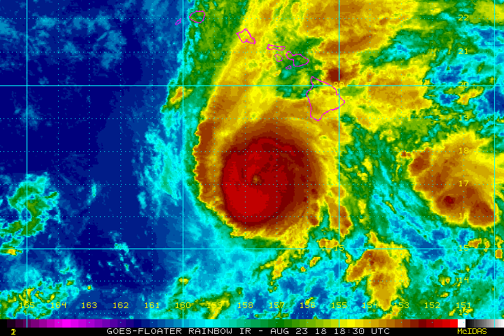
Hurricane Lane has weakened further today but remains a dangerous category three hurricane with sustained winds of 130 mph (kph). Outer rain bands have been producing torrential rainfall especially over the Big Island since last night. Rivers have risen well past flood levels, submerging much of the city of Hilo.
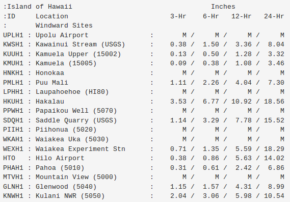
Rainfall totals have exceeded a foot over parts of the Big Island (see table above), including the city of Hilo. Even in a tropical environment, it’s too much rain for the soil and water system to handle. Combine that with elevated tides and surf due to the approaching hurricane and you have a recipe for widespread flooding (see tweets below). Additional rainfall in excess of a foot is likely, leading to additional severe flooding. Mudslides will be a common threat as well.
WOW!!! Rivers raging near #Hilo #Hawaii as water floods down from elevated areas. More torrential rain to come from #HurricaneLane video: @MilekaLincoln pic.twitter.com/K4fkqHxsdF
— WEATHER/ METEO WORLD (@StormchaserUKEU) August 23, 2018
A flash flood warning has been issued for East Hawaii until 12:45 a.m. and Bayfront Highway is currently closed in Hilo. Viewer Mia Carter shares flooding video from Orchidlands Estates in Puna: https://t.co/2Gi9qctpCA pic.twitter.com/RQOCpHiMTn
— khon2 News (@KHONnews) August 23, 2018
The latest model guidance brings the system further north than previously indicated. Although a turn to the west is still anticipated, the potential for a landfall has increased. The center of the storm could move very close to Honolulu by Friday night into Saturday. Eventually the storm should move west and by early next week, Lane will be moving into the open Pacific.
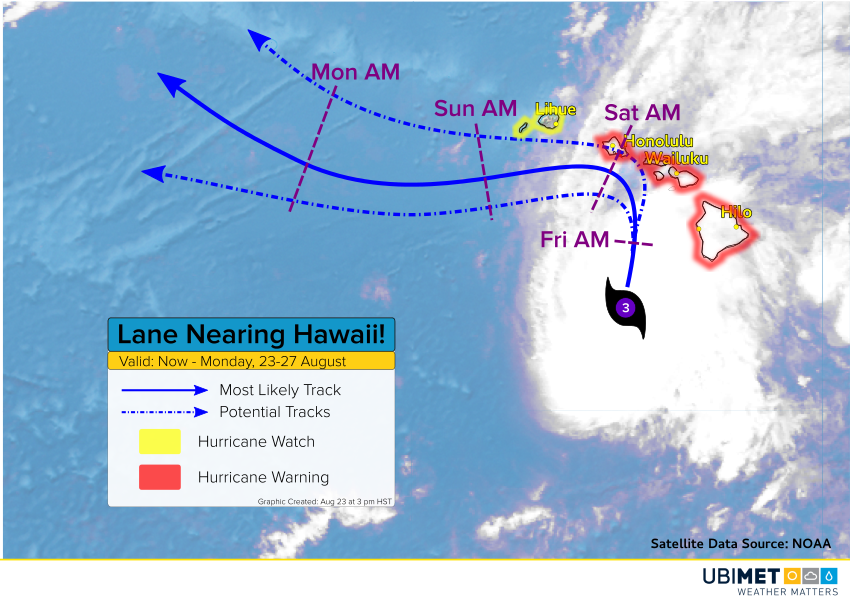
Lane is being hit by strong southwesterly shear, disrupting the circulation. Additional steady weakening is expected over the next few days. However, Lane could still be a hurricane as it closes in on the central Hawaiian Islands like O’ahu and Moloka’i. That means in addition to the ongoing flooding rains, high winds and storm surge will be increasing dangers. Wind gusts of 70-90 mph (110-140 kph) will lead to trees and roofs coming down with widespread power outages. A storm surge as much as 4-5 feet will inundate prone coastal areas.