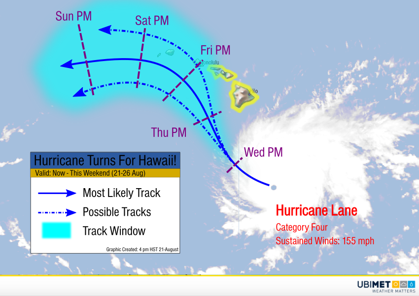
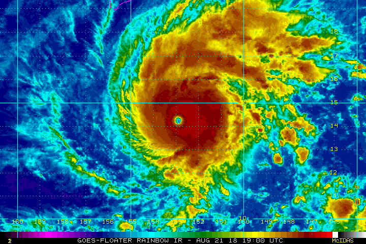
Satellite imagery this afternoon shows a very healthy looking Hurricane Lane churning south-southeast of Hawaii. Sustained winds have increased to 155 mph, almost to the category five threshold. To make matters worse, model guidance today has shifted the future track to the north and east. Only three hurricanes have moved directly over the islands since reliable record-keeping began. However, major impacts, possibly even a direct landfall, look much more likely for the islands later this week.
Hurricane watches have been posted by the National Hurricane Center for the islands south of Oahu. Additional watches and warnings are likely in the next few days. Lane is moving west-northwest but is expected to turn more northwest on Wednesday. By Thursday into Friday, the hurricane will be nearing the main Hawaiian Islands, including Maui and the Big Island. Eventually the cyclone will turn more to the west, but it’s not clear whether this turn will take place before or after passing through the islands.
Lane intensified significantly last night into earlier today. It is unlikely that much more intensification will occur. Slow weakening is more probable as the system moves into cooler waters. However, even if a gradual weakening trend does occur, Lane will still be a powerful cyclone. Flooding rains, damaging winds, and a significant storm surge are likely even if the storm remains slightly offshore. Obviously a direct landfall would mean more severe impacts.