Weeks to months of below-normal precipitation have lead to dangerous drought conditions over the Southern Plains. Some areas have entered the “exceptional drought” stage, the most severe category. Fortunately, a combination of Gulf moisture and a stationary upper level trough will mean a good chance for heavy rain across the region on Sunday. While that’s potentially good news for farmers looking to rescue suffering crops and livestock, few will welcome the localized flooding that could occur.
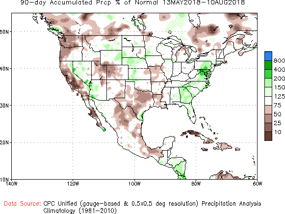
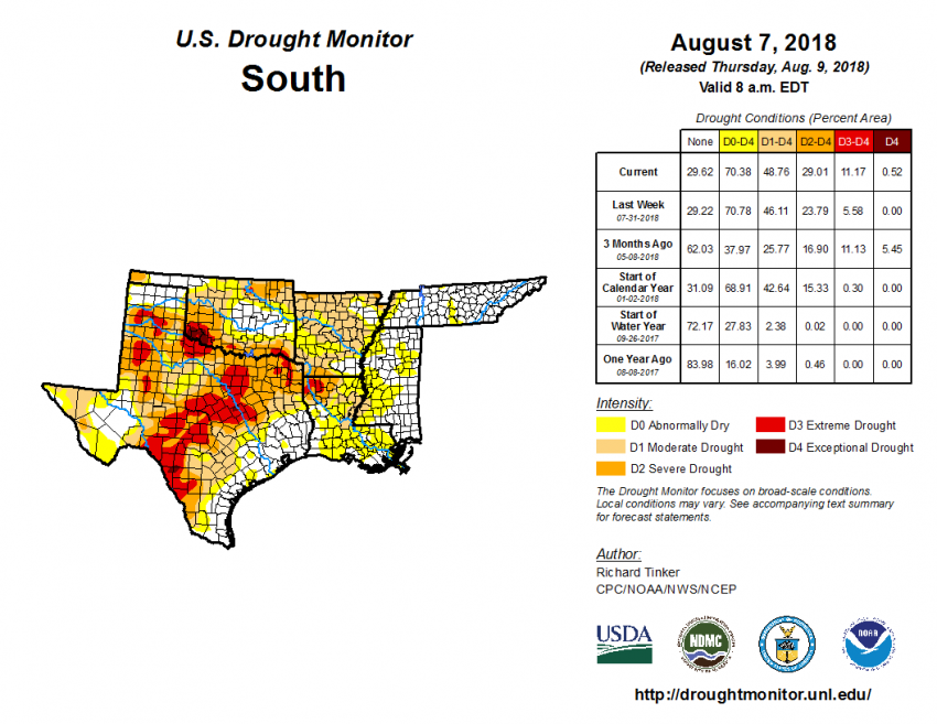
The last few months have been exceptionally dry across Texas (see graphic above from the Climate Prediction Center). One result has been a dramatic increase in land officially designated as drought-stricken (see graphic below). More than 70% of the territory in the US Drought Monitor’s South region is now in drought category, compared to 38% in early May. The worsening drought has prompted government officials to implement mandatory water restrictions, some severe, in nearly 700 localities.
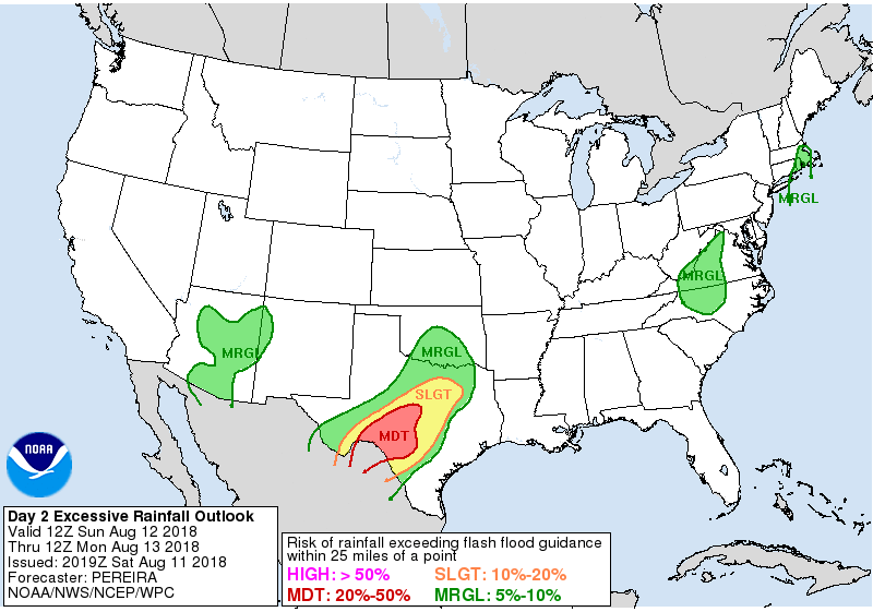
The forecast for Sunday offers some hope for at least temporary relief, even as far north as the Dallas metro. A nearly stationary upper-level trough is in place over the interior Plains. Meanwhile, surface wind trajectories are moving Gulf moisture northwest into the drought region. The combination will bring slow-moving showers and storms through much of Sunday. Most of the area will see 1-2 inch (mm) rainfall amounts with localized amounts of 3-5 inches (mm) likely. Unfortunately, rainfall rates will be briefly heavy, resulting in localized flooding.