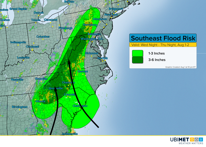
This summer’s pattern of wet weather in the Eastern U.S. is getting a fresh influx of tropical moisture. Persistent south to southeast flow will bring moisture up to the eastern slopes of the Appalachians. Expect flash flooding through tonight and Thursday.
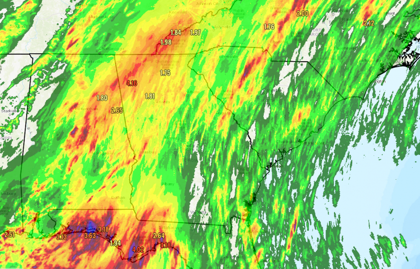
Torrential rain has been falling today across portions of the mid-South and Gulf Coast, up to 6-8 inches (150-200 mm) in spots (see above). Flash flooding affected the city of Mobile in southern Alabama earlier today:
Flash Flooding in Mobile, Alabama Wednesday afternoon had Emily Ericsson breaking out the kayak…on Selma Ave! @spannwx @stormhour @weathernation @garofalowx @chrisdbianchi @nws @nwasorg #turnarounddontdrown #flood #flooding #weather #storm #rain #kayak https://t.co/NpqVlpcQ6S pic.twitter.com/TMucHHC0Px
— Chris Dunn (@Chris_WPMI) August 2, 2018
For tonight and Thursday, the main flood threat will shift towards the foothills and east-facing slopes of the southern and central Appalachians, from Georgia and South Carolina up to Pennsylvania. Many areas will see 1-3 inches (25-75 mm) with 3-6 inches (75-150 mm) more common in the foothills and mountains. Significant flash flooding will be the result – extreme caution is advised for anyone traveling near or through the mountains in the next few days. Mudslides could also affect secondary roads.