July 2018 brought a smattering of temperature and precipitation extremes to the United States.
The western US experienced a very dry month that exacerbated wildfire issues, while portions of the Mid-Atlantic saw record rainfall that lead to flooding problems. Below are several maps that break down the temperature and precipitation departures across more than 800 climate stations over the contiguous US for July 2018.
Temperature Departures
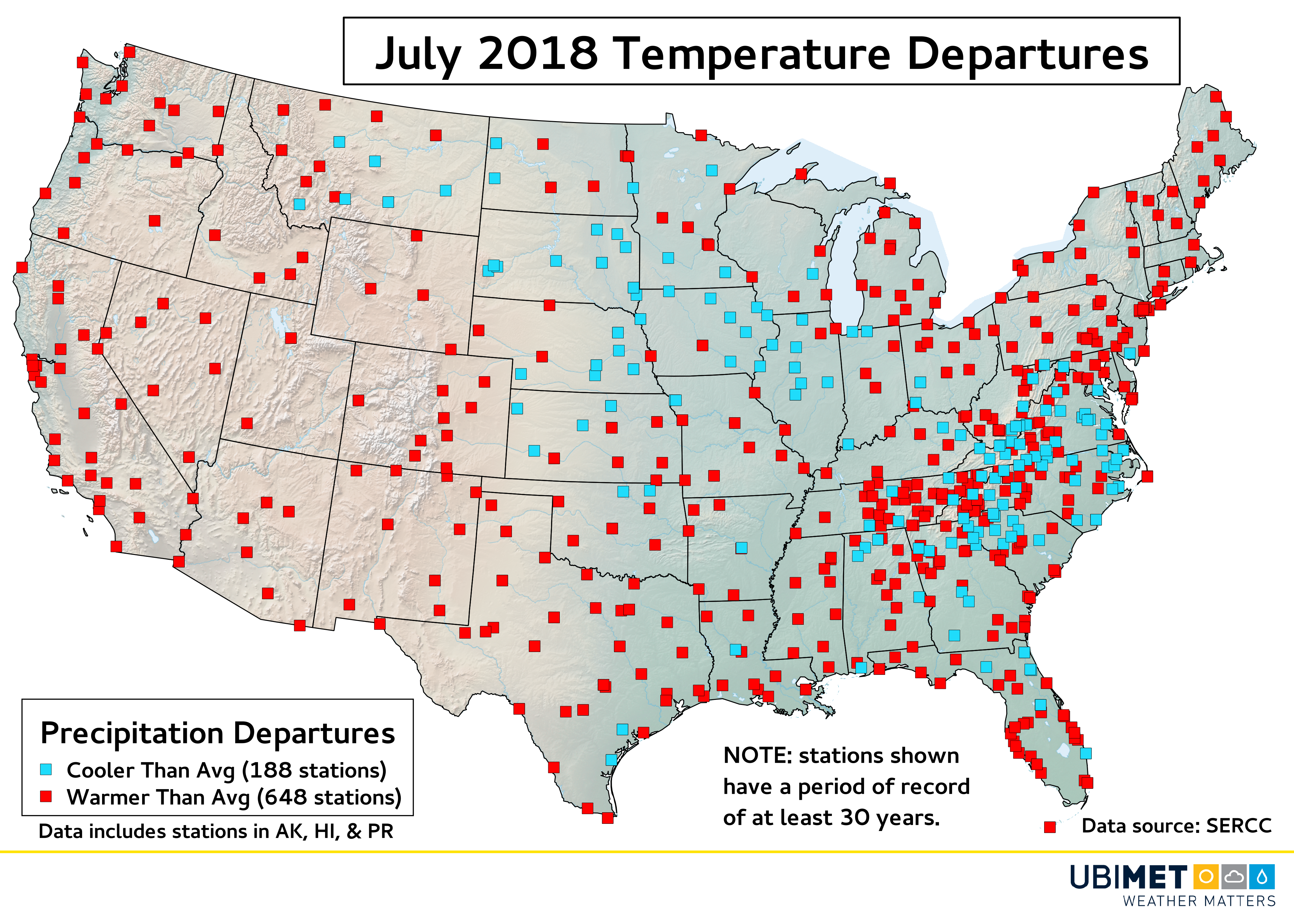
Temperatures across the US favored warmer than average conditions over cooler than average by a ratio of more than 3:1. Some cities that have (unofficially) set new record July mean high temperatures include: Key West, Florida, Albany, New York, Caribou, Maine, and Long Beach, California.
Some locations from the Midwest to the central Appalachians experienced a cooler than average July. Burkes Garden, Virginia has (unofficially) experienced it’s coldest mean July temperature on record.
Precipitation Departures
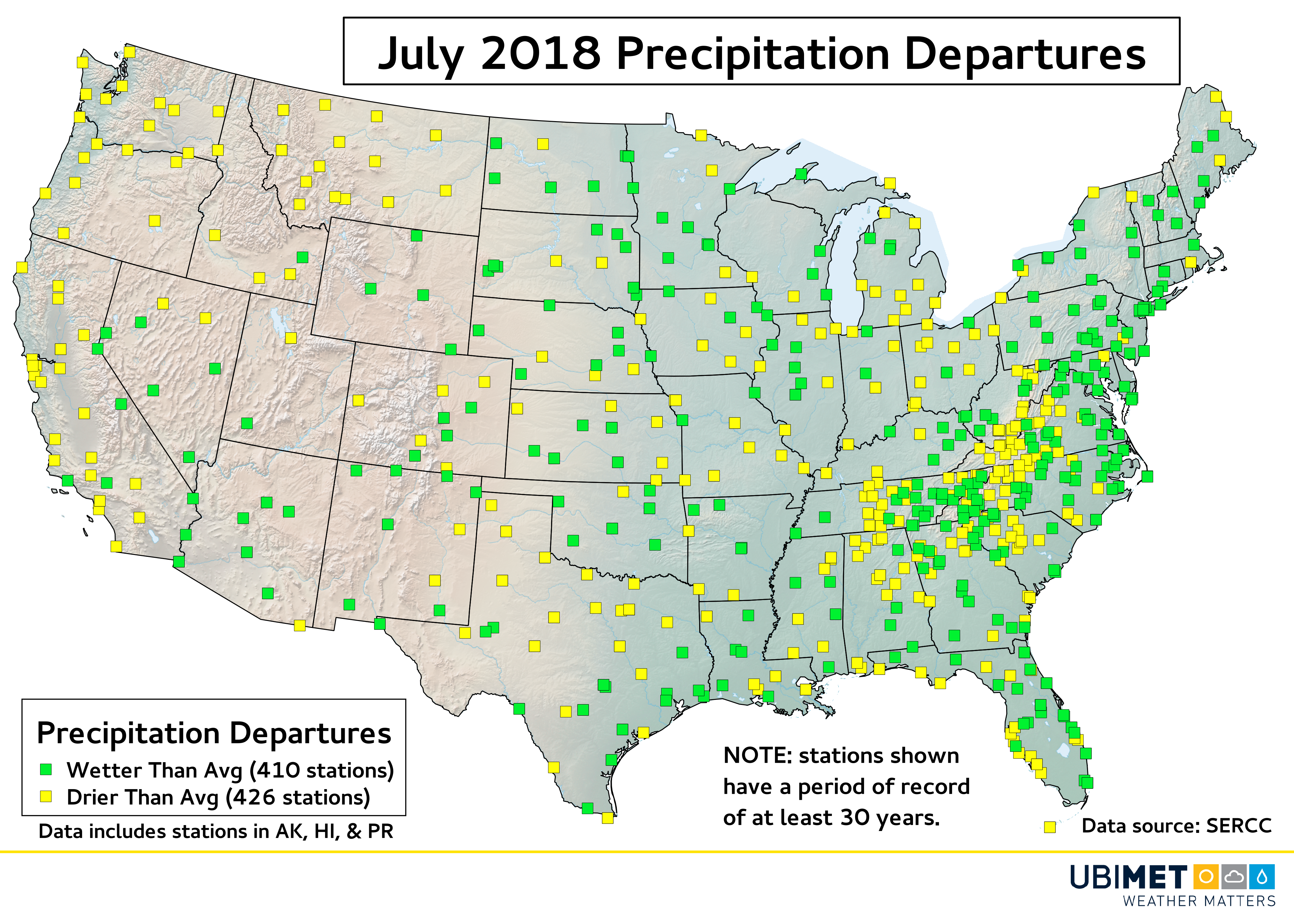
Precipitation departures varied widely across the contiguous US, which highlights the hit-and-miss nature of summertime thunderstorms.
In additional to being hot, much of California and the Pacific Northwest were drier than average. Meanwhile farther east, the northern Mid-Atlantic experienced a very wet July that was highlighted by a week of heavy rain and storms during the latter part of the month.
Some bigger cities that saw their record wettest July on record include Baltimore, Maryland and Harrisburg, Pennsylvania.
Temperature and Precipitation Records
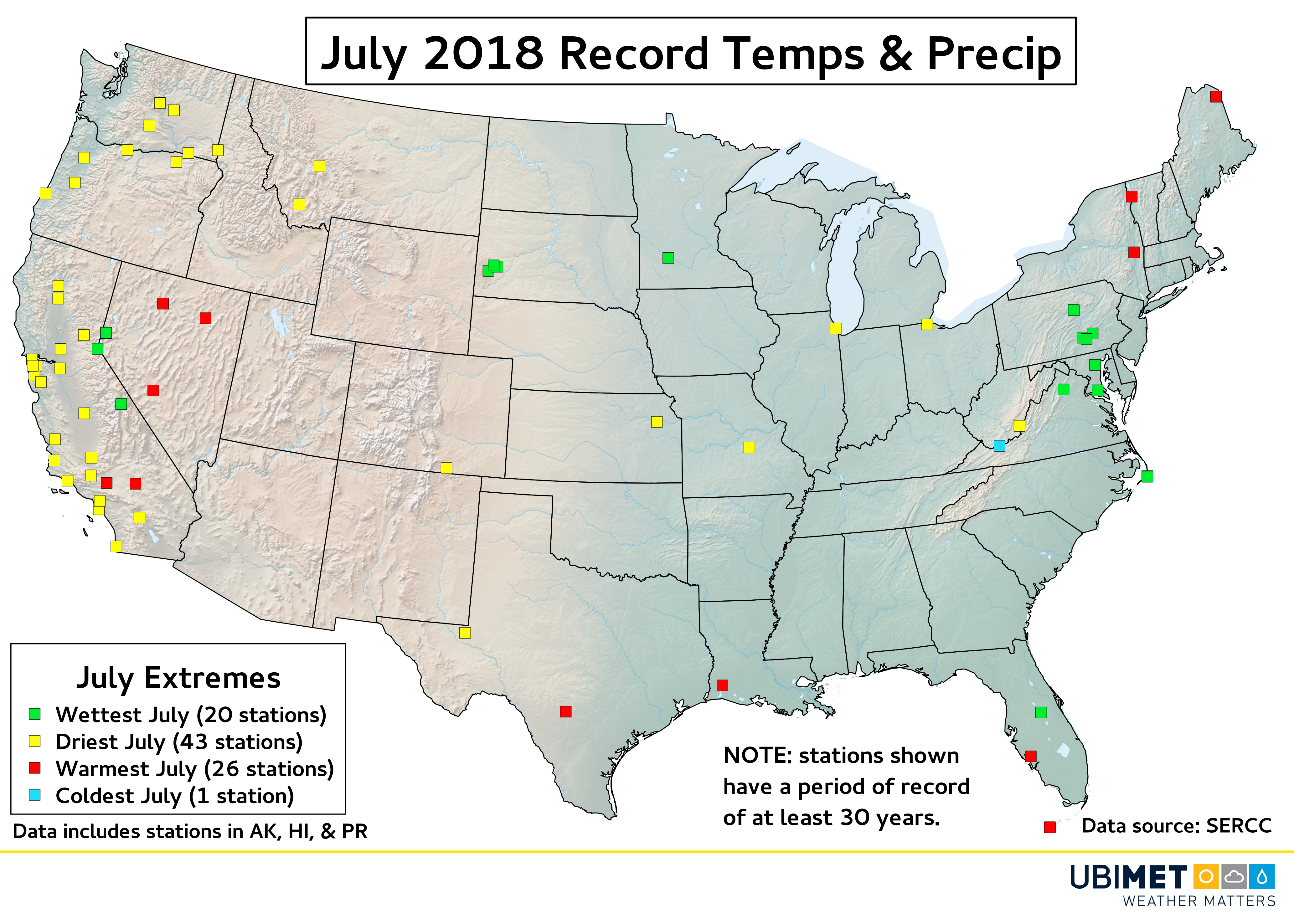
While official temperature and precipitation values for July are still being evaluated for quality control, as it stands on 1-August there are 90 climate stations across the US that have set or tied a new July temperature or precipitation record.