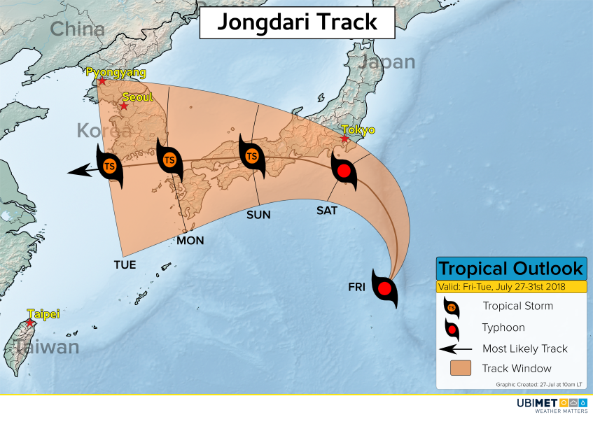
Jongdari is gathering strength across the West Pacific Ocean this week. The cyclone will take a track toward Japan and it is expected to impact the country this weekend.

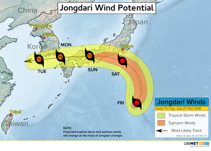
Environmental conditions such as low wind shear and warm ocean water temperatures of 30-32C will allow Jongdari to become a formidable typhoon by Friday and Saturday.
Steering winds will take Jongdari toward the northeast through Friday, however, a blocking high pressure system over the north-central Pacific Ocean will then force the cyclone toward the northwest and into Japan on Saturday.
Jongdari Impacts

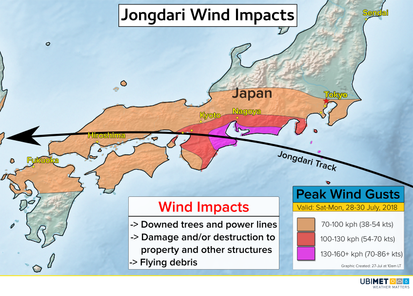
Wind gusts as Jongdari comes ashore will top out in the 130-160 kph range with isolated higher gusts. These speeds will bring down trees, cause power outages, and cause damage and destruction of some property.
The Tokyo metro area will be on the northern fringe of Jongdari’s wind shield. Gusts to around 70 kph will be possible which can still down trees and power lines and cause minor property damage.

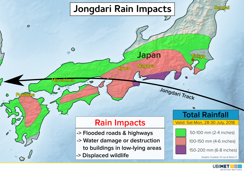
Heavy, tropical rains will accompany Jongdari as the cyclone moves across southern Japan this weekend. Up to 200 mm of rain is expected across communities near the landfall location for Jongdari. Rainfall in the mountains will be locally higher than what is depicted on the rainfall map above.
Japan has been in the midst of a record-breaking heat wave that has been responsible for several dozen fatalities as well as disruptions in power. In addition, at the beginning of the month much of southern Japan was inundated with heavy rain that totaled more than 500 mm in a span of just 3 days. The impending impacts from Jongdari this weekend will not come as welcomed news.
