
Temperatures are approaching 110 degrees Fahrenheit (43 deg C) this afternoon in the Dallas metro area. It’s the fourth day in a row of record-breaking heat. Fortunately, there could be some light at the end of this stifling tunnel.
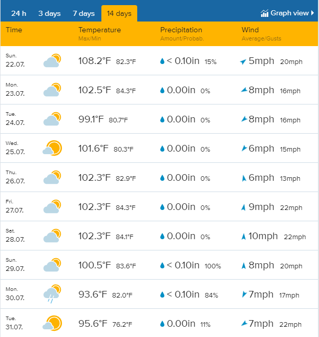
It’s been a hot summer overall in the Southern Plains. Since Dallas-Ft. Worth saw a high of 73 deg F (23 deg C) on May 4th, residents there have had barely any break from the heat. There have been only four days in the intervening time when highs haven’t surpassed 86 deg F (30 deg C). Average temperatures have been 5.1 degrees, 4.4 degrees, and 3.7 degrees above normal in the months of May, June, and July respectively. Dallas is currently on a nine-day streak of highs above 100 deg F (38 deg C), and as you can see from the Morecast.com forecast below, there’s at least one more week of heat left to go.
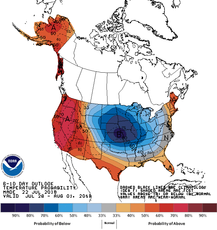
Fortunately, the longer range forecast is promising. The sprawling upper-level ridge that has been anchored over the West and Plains for the past few weeks is expected to shift back towards the West coast, allowing some cooler Canadian air to slide down the Plains. The 6-10 day forecast below shows a welcome surge of cooler-than-normal air in the Plains. Keep in mind this is only a trend back towards normal in the Southern Plains; the Dallas metro area would still expect to see highs in the low 90s this time of year.
Residents of the Desert Southwest are used to seeing thermometers top the 100-deg mark most afternoons in the summer. However, some of the hottest air of the summer thus far has moved in. Highs in Phoenix over the next 3-4 days could exceed 115 deg F (46 deg C) with really hot spots like Blythe, California threatening 120 deg F (49 deg C)! Excessive heat warnings will also expand up the West coast later this week into next week if the outlook above bears out.