
A quick moving cold front will bring a period of strong to potentially damaging winds to parts of SA, VIC, TAS and NSW on Tuesday. The highest winds are expected along the coast and across the mountainous terrain.
Windy Weather Setup
A vigorous wintertime disturbance and cold front will move from the Bight across southeast AU on Tuesday. At the same time, high pressure will be positioned near Brisbane. The counter-clockwise flow around the high pressure combined with the approaching cold front from the Bight will generate an 8-14 hour period of high winds.
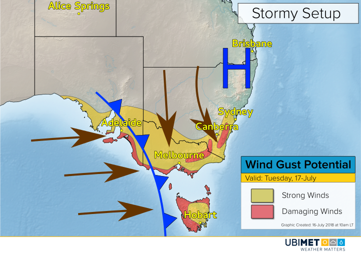
Winds will increase out of the north and northwest early Tuesday. Once the cold front passes, winds will shift to the west in many locations.
A band of gusty showers and isolated thunderstorms will accompany the cold frontal passage. Localised wind gusts higher than whats depicted on the map below are possible in the strongest showers or thunderstorms.
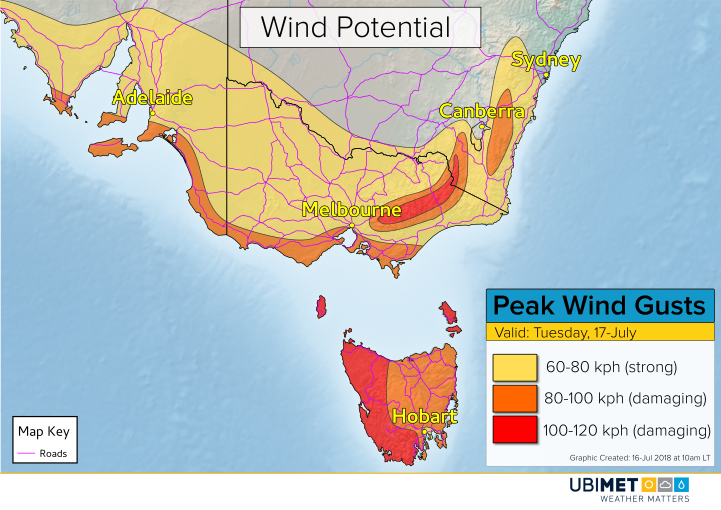
Damaging wind gusts of 80 kph or greater are possible from coastal SA into coastal southern VIC and across most of TAS. Additionally, the Alpine region will also see the potential for damaging winds, particularly at elevations above 1,000 meters.
Winds will remain gusty across portions of SA, VIC, and TAS on Wednesday as the unsettled weather pattern continues.