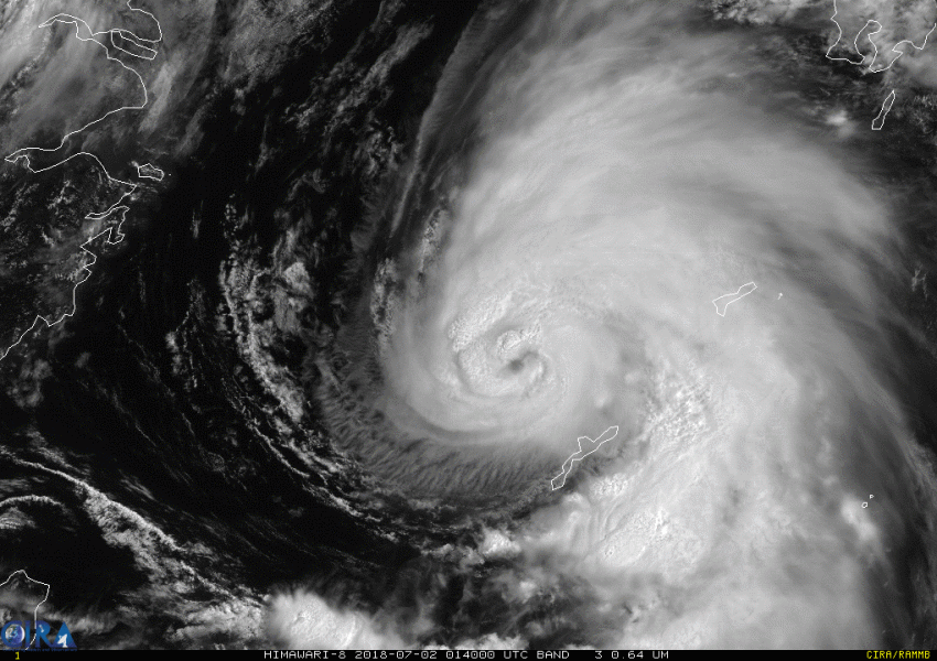
Small but fierce Typhoon Prapiroon is currently moving north just east of the Ryukyu Islands. Model guidance is in good agreement that the typhoon will pass through the Korean Strait in the next few days. Heavy rains and winds are likely for portions of Japan and South Korea.
The typhoon is only producing damaging winds within 25 miles (km) of the center. However, stronger bands are capable of producing brief gusts as high as 100 mph (165 kph). Conditions are favorable for Prapiroon to maintain its current intensity or perhaps even strengthen a bit today. Much cooler sea surface temperatures and stronger upper level winds wait for the typhoon as it moves closer to Korea and Japan on Tuesday. Fortunately, rapid weakening is expected before the small circulation moves close enough to the Japanese and Korean coasts.
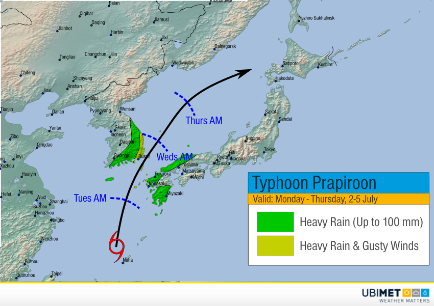
Heavy rains will be a threat for extreme southern Japan and southeastern South Korea. A few areas in the mountains could see upwards of 100 mm. Strong winds will be a very localized concern, but a few gusts of 80-100 kph could affect the coast, especially of South Korea on Tuesday night. The storm will move into the Sea of Japan later on Wednesday, slowing down and dissipating through the end of the week.