An outbreak of severe thunderstorms on Tuesday afternoon produced a tornado that was observable from Denver International Airport (DIA).
A cell tower camera at the airport captured an image of what was later confirmed to be a tornado.
Right now DIA camera .https://t.co/dssU35WCwQ #cowx pic.twitter.com/YRqtmFh6fb
— Viaero WX Cameras (@ViaeroWXCams) June 19, 2018
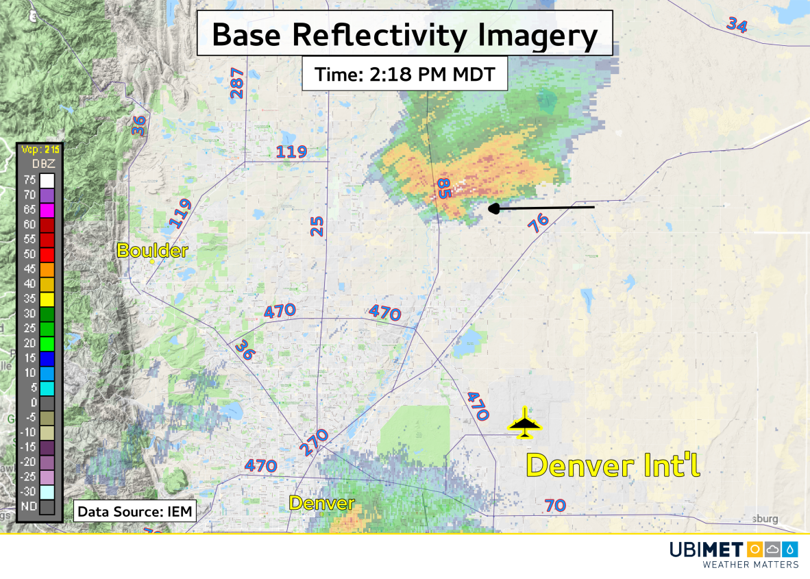
A reanalysis of radar imagery from the storm shows that the tornado touched down about 15 miles (25 km) north of the airport. The black arrow in the follow image indicates approximately where the tornado would have been.
Additional storms fired in the Denver area during the later afternoon and evening hours prompting hundreds of arrival and departure delays at the city’s international airport.
Other Severe Storm Reports
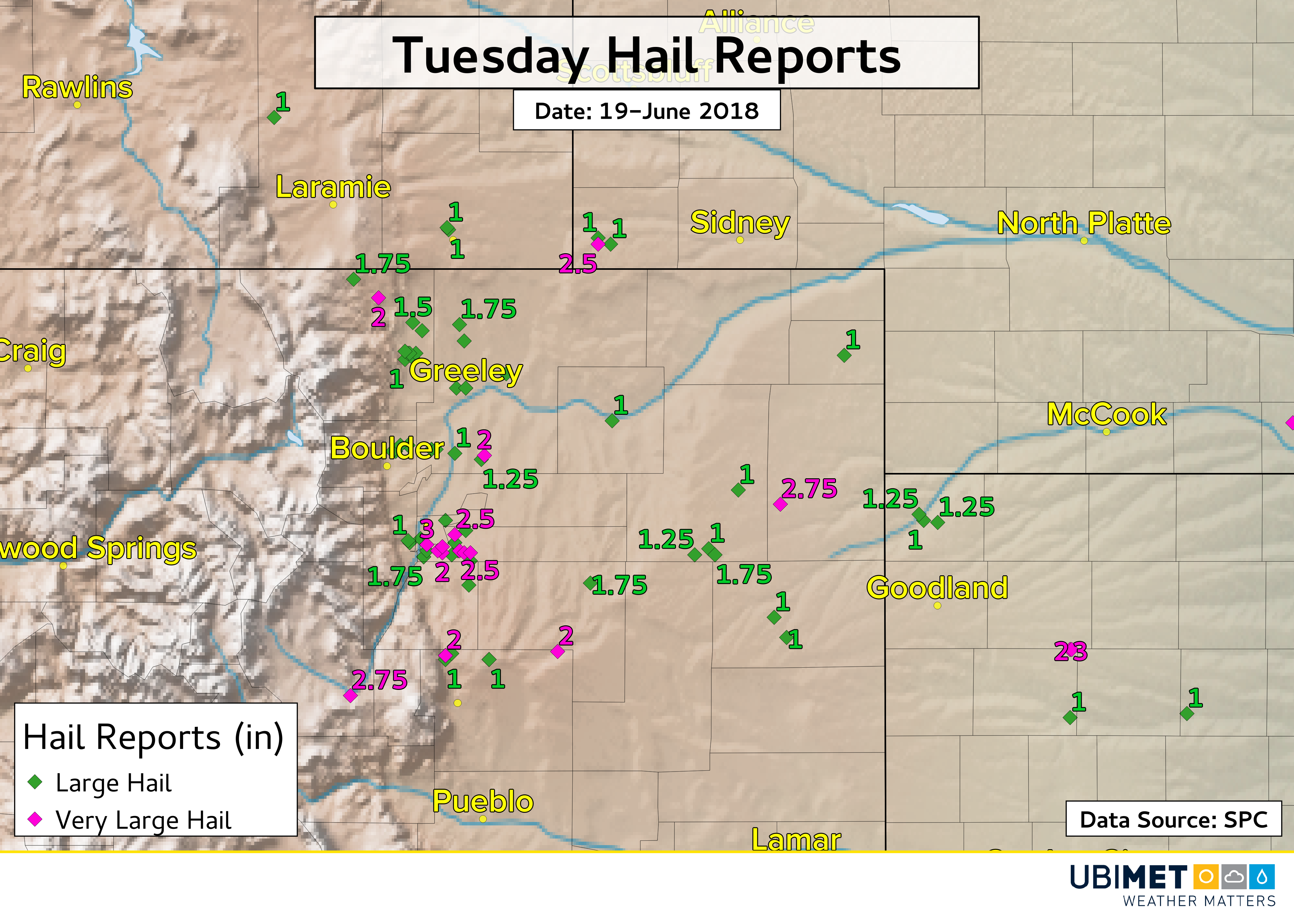
Denver was not the only city targeted by severe weather on Tuesday. There were other severe thunderstorms across eastern Colorado and other areas of the High Plains that produced many instances of large hail.
Hail up to the sizes of tennis balls and tea cups (2.5 to 3.0 inches) were observed in Arapahoe County, Colorado, which sits to the southeast of Denver.
Some twitter users posted videos showing copious amounts of hail falling from a thunderstorm. Two of the more impressive video tweets are shown below.
Trees shredded. Garden destroyed. #cowx pic.twitter.com/IIaXzJHrnH
— Rob Valentine (@valentinerob) June 19, 2018
Hey, Greg Dutra! 7 minutes of hail in Northeast Fort Collins. @KDVR @PinpointWX pic.twitter.com/XwFDcYkj03
— Kelly R. Kappel (@KellyRKappel) June 20, 2018
Wednesday will bring quieter weather to the High Plains as the storm system responsible for the severe weather moves out of the region.