
A hot and muggy air mass provided ideal conditions for record-breaking temperatures and scattered severe storms across the Northeast on Monday.
Record Temperatures
Unofficially, 18 record highs from the Midwest to the Northeast were tied or broken on Monday.
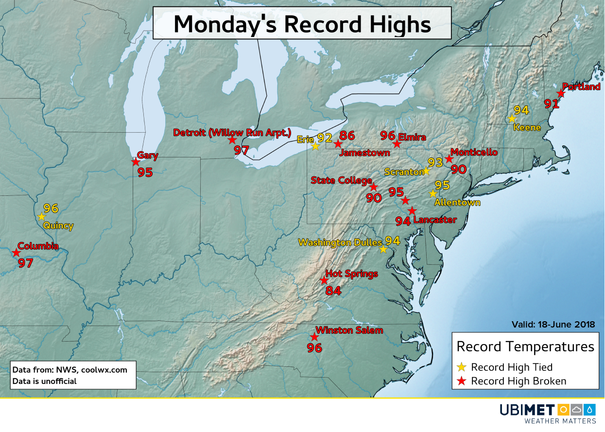
At Washington, D.C. Dulles Airport, the high of 94 degrees tied a record from 11 years back in 2007. Elsewhere, highs in the middle 90’s across central Pennsylvania and southern New York state broke several record highs, many of which were from the 1990’s.
A cold front will drop through the Great Lakes and Northeast on Tuesday bringing some relief from the heat and humidity. Across the southern Mid-Atlantic and Carolinas, Tuesday will end up hotter than Monday in some cities as the cold front will remain north of the area.
Severe Weather
In addition to the hot weather, an abundance of moisture in the atmosphere help fuel several clusters of severe thunderstorms across the Northeast.
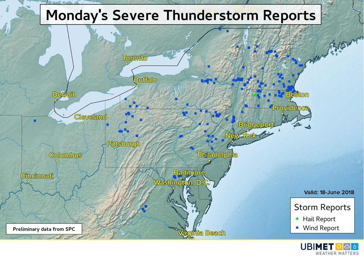
There were a total of 191 wind and hail reports recorded by the Storm Prediction Center from Ohio to Virginia northward to Maine.
Many of the wind reports featured downed trees and power lines. In Poughkeepsie, NY, strong winds from severe thunderstorms lead to a building collapse injuring one person that was inside. Across southern Maine, severe storms knocked out power to thousands of customers.
One of the most impressive storms of the afternoon was a potential tornado producing storm across southern New Hampshire.
And yet another view of the Durham, NH funnel from Shannon Carmody Keyes #wbz https://t.co/ZXJLcyVFkv pic.twitter.com/qhXezSFYBN
— Eric Fisher (@ericfisher) June 19, 2018
In the wake of Monday’s severe weather, the Northeast will get a break from the severe weather on Tuesday as the cold front brings in a drier more stable air mass.