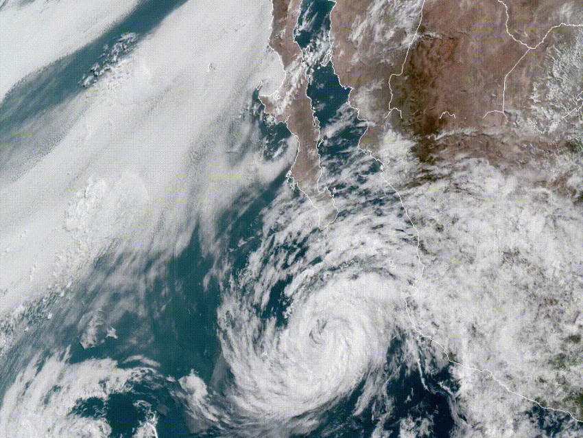
Tropical Storm Bud was a major hurricane as recently as Tuesday morning, when it boasted a peak sustained wind of 130 mph (210 kph). However, over the past 24 hours the storm has quickly entered much cooler ocean waters that have resulted in rapid weakening (see graphic below). Bud will continue to weaken, but will still pose a threat for heavy rain and flooding from the Baja California into northwest Mexico and the U.S. Desert Southwest.
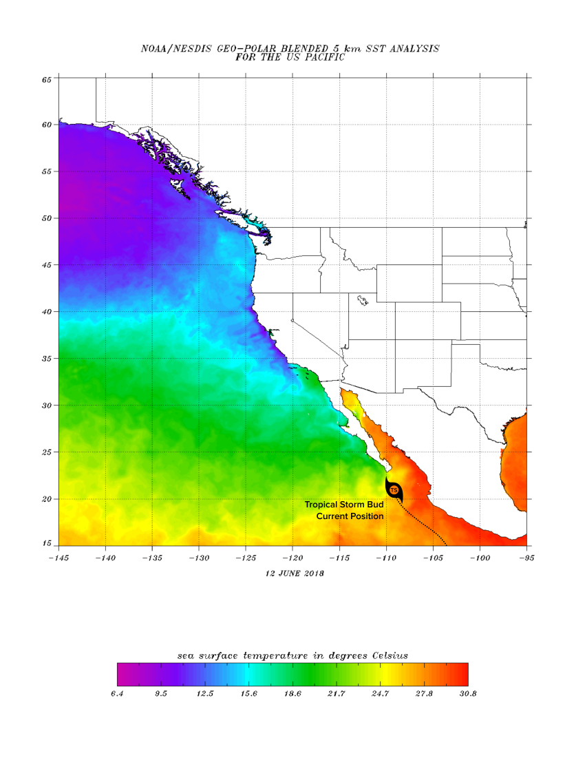
Bud is now located about 190 miles (305 km) south-southeast of Cabo San Lucas, Mexico, moving north-northwest at 6 mph (9 kph). Trends suggest the storm will continue to move generally north into the southern Baja California, then northeast towards northwest Mexico near Obregon. While gusty winds could be a minor concern for some coastal spots, heavy rain will be the much more widespread and dangerous threat.
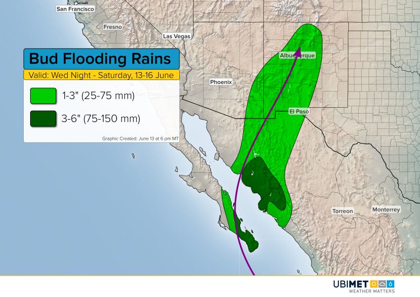
The heaviest rains of 3-6 inches (75-150 mm) are expected from the southern Baja California into the adjacent part of mainland Mexico, especially in the west-facing slopes and foothills of the central Sierra Madre range. Localized amounts higher than six inches are likely. Expect serious flash flooding in this area, along with mudslides in steeper terrain. Lesser amounts of 1-3 inches (25-75 mm) will occur elsewhere, including into parts of southeast Arizona and New Mexico.