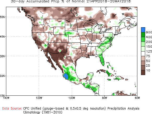
A muggy, wet summertime pattern has set up across much of the eastern half of the U.S. over the past several weeks. Persistent southerly flow has been pulling moisture up from the Gulf of Mexico and the tropical Atlantic. The result has been two to four times the normal precipitation amounts from Florida up to the Mid-Atlantic since late April (see graphic below courtesy the Climate Prediction Center). Long-term trends and model guidance indicate this pattern will continue through much of the summer.
One of the prime mechanisms controlling long-term climate forecasting is the ENSO (El Nino Southern Oscillation), variations in sea surface temperatures across the Pacific basin. Currently neutral, the ENSO will be trending more positive and could be designated an actual El Nino later this year. In the shorter term, the Madden-Julian Oscillation (MJO), a globe-circling wave of clouds and rain, will remain active. This pattern is sometimes associated with increased tropical cyclone activity in the Atlantic basin, which would tend to support the idea that rainfall will be above normal. Global models have been tending to generate cyclones in the longer range (two weeks out). Even if cyclones don’t develop (it’s a bit early to reasonably expect them), an open tropical moisture tap can be expected to continue.

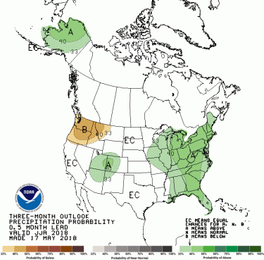
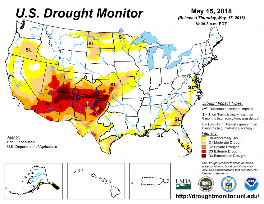
The one- to three-month forecasts above reflect the expectations for continued warm, wet weather. Unfortunately, this enhanced rainfall will continue to miss the extreme drought now stretching from the Four Corners region into the southern High Plains (map below).