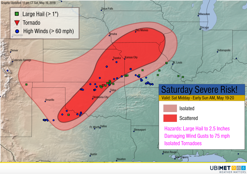
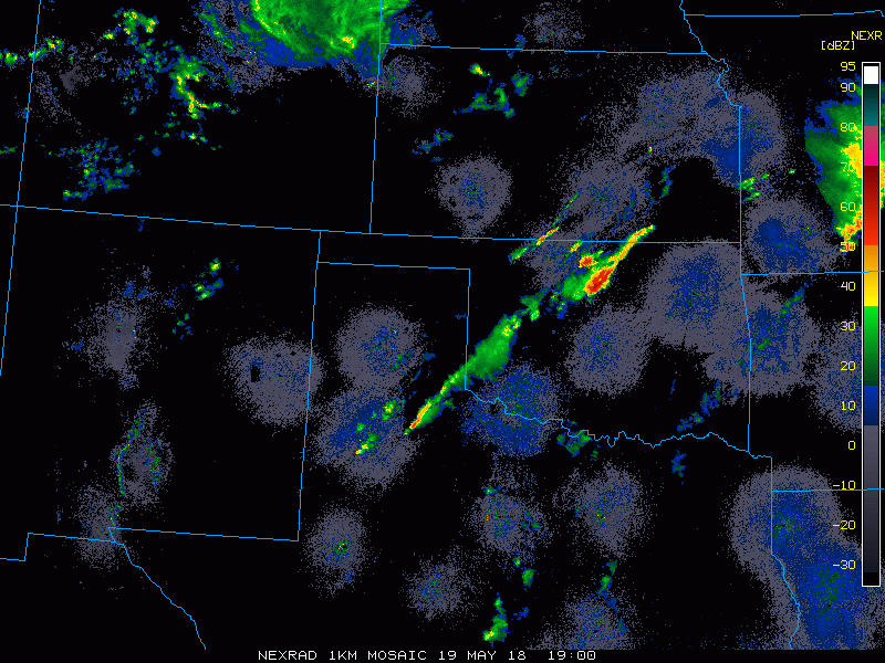
Heat and humidity sparked severe storm development on Saturday from the Texas Panhandle through southeast Kansas and southern Missouri. As you can see on the radar loop below, the storms took a variety of forms, from individual supercells to bowing squall lines and multi-storm clusters. Several reports of hail in the 2-3 inch (7.5 cm) diameter range were received, along with wind gusts of 70-75 mph (120 kph). At least one tornado touched down with a long-lasting severe cell in northern Oklahoma in the mid-afternoon.
Despite indications from model guidance on Friday, severe storms never developed from Topeka, KS through Kansas City to northern Missouri and southern Iowa. Instead, the corridor of severe storms ended up being from the Kansas-Oklahoma border to southern Missouri. These severe storms sapped unstable energy that otherwise might have fueled storms further north.