The first major fall storm of the season is set to impact southeast Australia through the end of this week. Accompanying the fall storm will be rain and the potential for flooding, strong winds, and mountain snow.
Wednesday
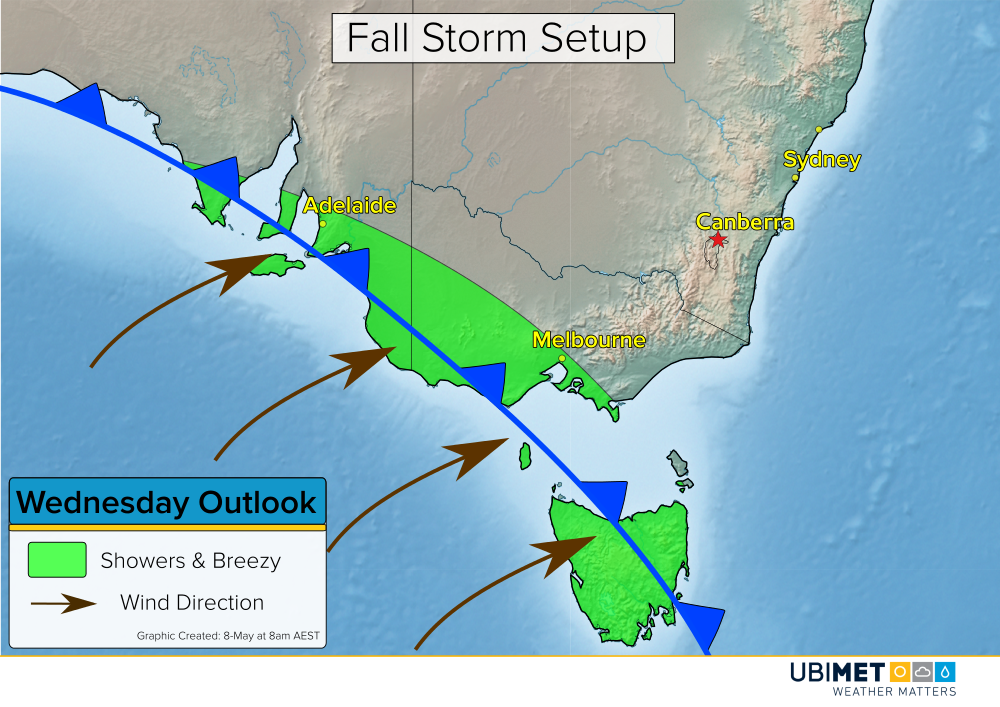
A cold front will cross the Bight on Wednesday and move into coastal southeast AU by day’s end. Gusty showers and isolated thunderstorms will accompany the frontal passage. The cold front is expected to reach Adelaide on Wednesday evening and Melbourne Wednesday night.
Thursday
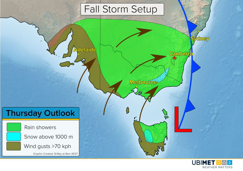
The cold front will sweep across southeast Australia on Thursday. Additionally, low pressure will develop near TAS and help drive strong south to southwesterly winds across the region. Gusts of 70-100 kph are likely along the coast as well as across the mountains.
Periods of rain will accompany the strong winds in many locations. Heavy rain will be likely near and to the west of the low pressure system. The heaviest rain on Thursday will likely be across TAS, especially near the Hobart area and surrounding hills.
In additional to the rain and wind, temperatures above 1,000 meters will get cold enough for the rain to change over to snow at times. A significant amount of snow in excess of 30 cm is likely at elevations above 1,300 meters between Thursday and Saturday.
Friday
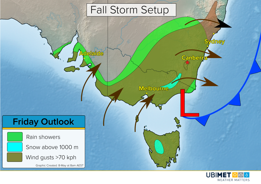
Low pressure will drift northward on Friday continuing the strong wind and rain threat across much of southeast AU. Periods of heavy rain will spread northward across southern and eastern VIC.
The moist southerly flow on the west side of low pressure will combine with increasing elevation will bring an elevated risk for flooding to the VIC hills and Alps. The threat for heavy rain and flooding will continue across eastern VIC into Saturday.
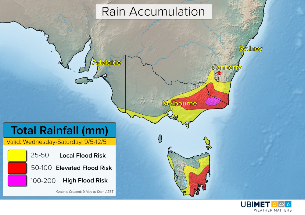
The strongest storm-related impacts are expected to lighten up by Sunday, however, lingering showers and breezy conditions are likely from eastern VIC up to the central NSW coast.