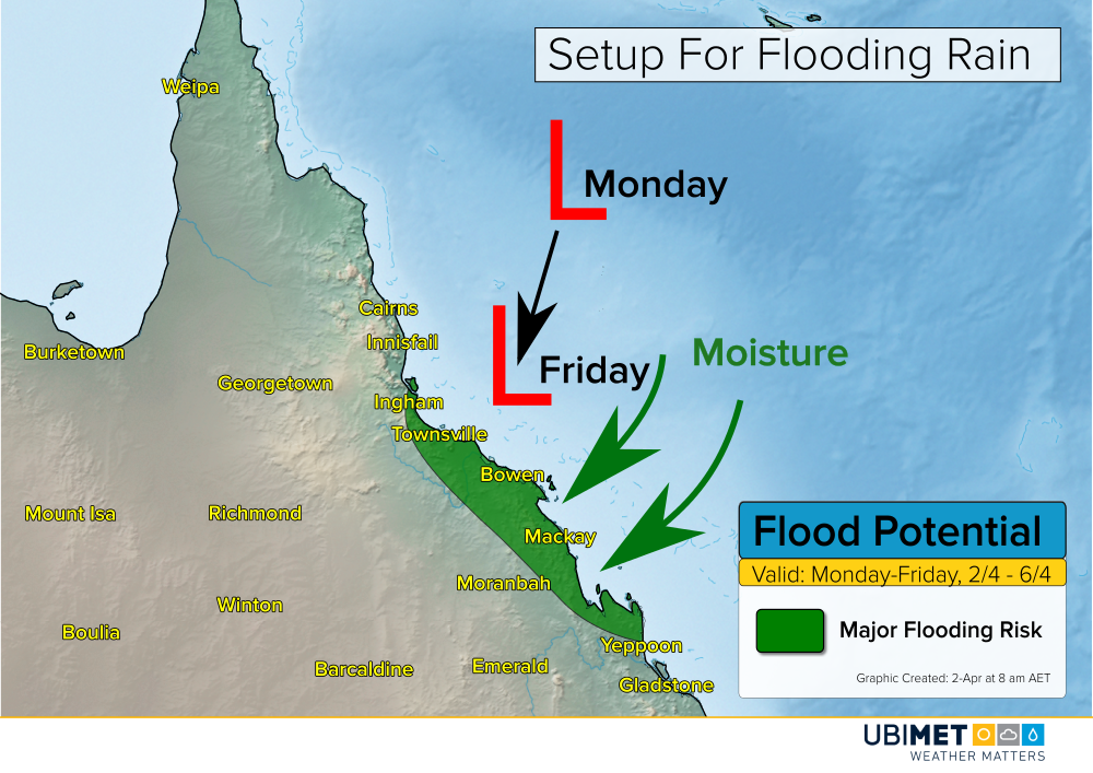
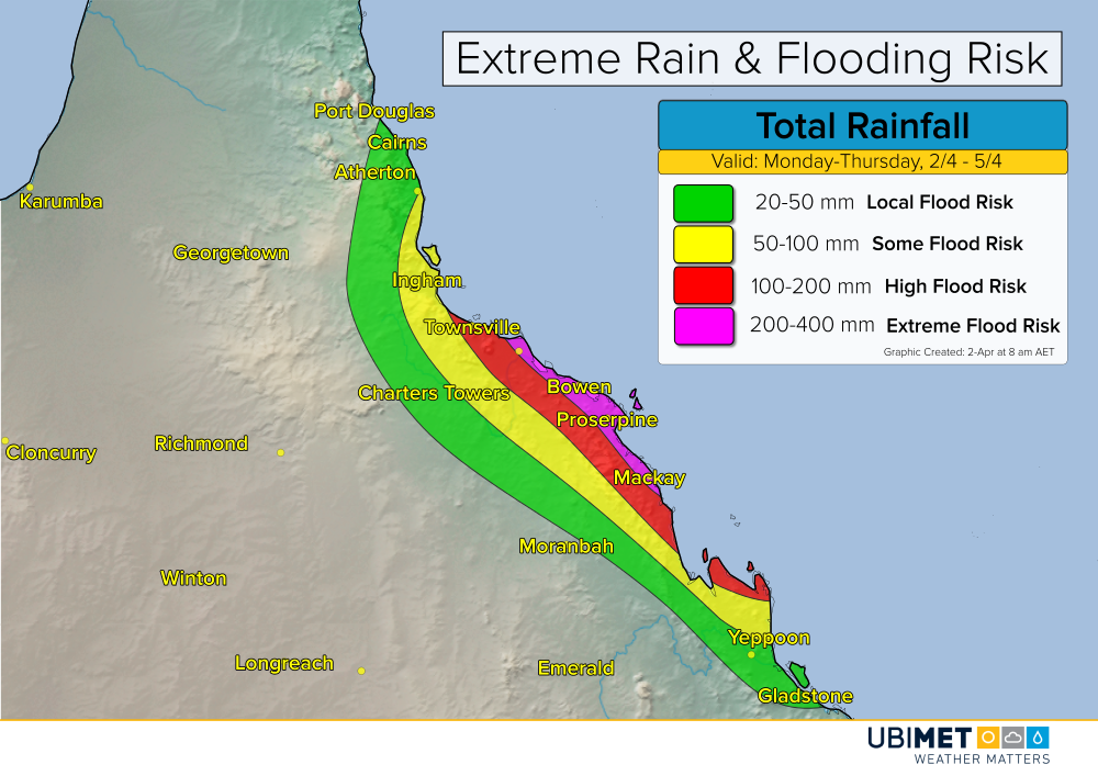
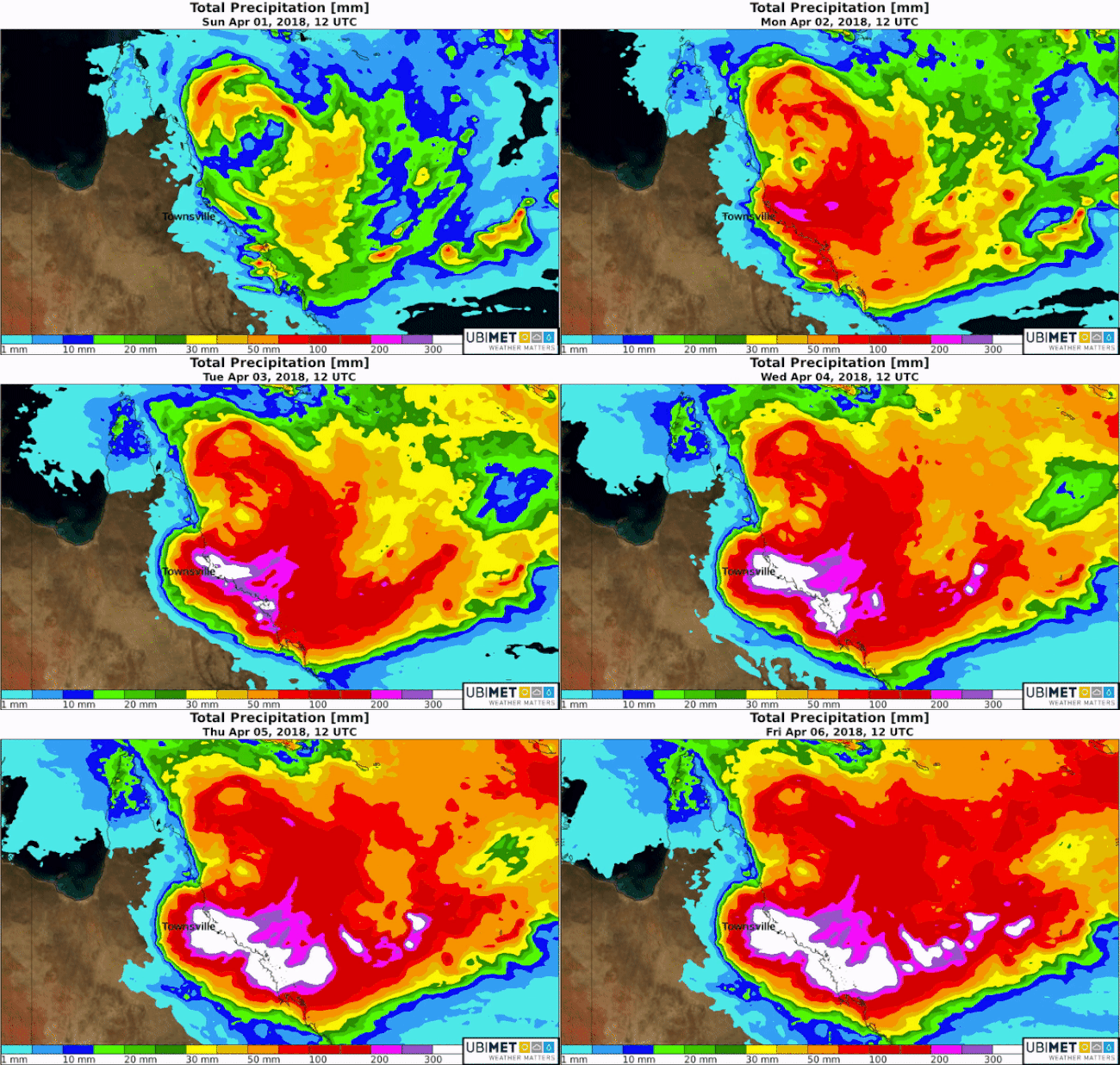
A slow moving tropical low pressure system over the Coral Sea has strengthen into TC Iris on Monday. Iris will bring rounds of heavy thundery rain to the central QLD coast this week. The precipitation will bring the threat for major flooding from Ingham to Townsville to Mackay.
The Details
Iris will move slowly toward the central QLD coast this week. If the center of the storm stays out over water this week, the Iris could continue to strengthen some this week.
Regardless of strength, a persistent onshore flow will bring an abundance of moisture and numerous rounds of heavy precipitation to the central QLD coast.

Extreme rainfall amounts are possible, particularly right along the coast. 5-day rain totals of 200-400 mm are possible. That is a rate of about 50-75 mm each day this week.
These types of falls will bring the risk for major and widespread flooding along the central QLD coast. Mudslides, washed out roads, and building damage due to flood waters are likely in regions that experience the heaviest rain.

Iris is expected to gradually weaken by this upcoming weekend. This will bring an end to the heaviest rainfall, however, scattered thundery showers are still expected to persist.
