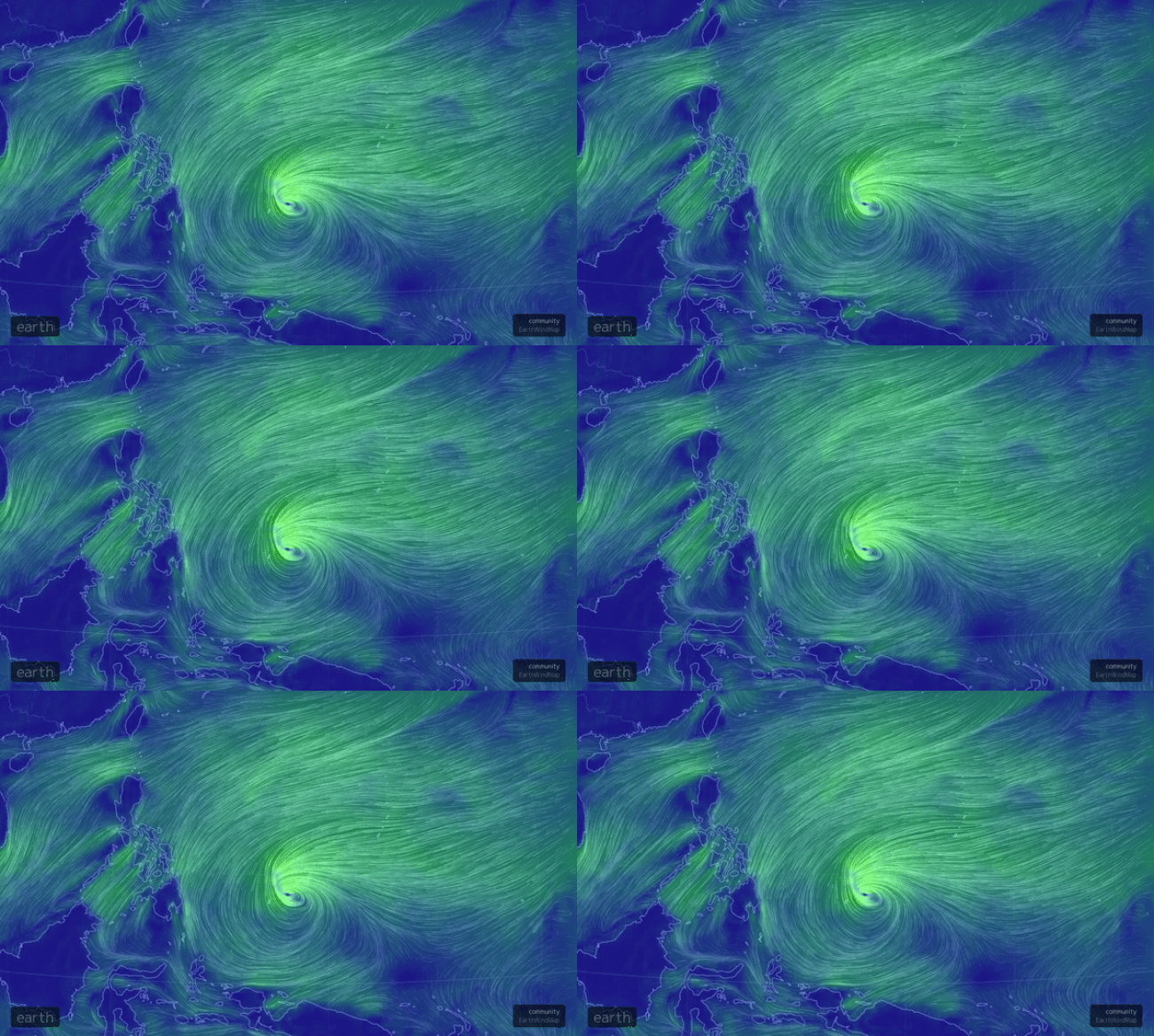
Tropical Storm Jelawat developed in the West Pacific on Sunday, however, it is not expected to threaten any major landmasses.
Future Track Details
The center of Jelawat passed in between the island nations of Micronesia and Palau on Monday. The Micronesian island of Yap Island picked up over 180 mm of rain early this week as the center passed off to the west.
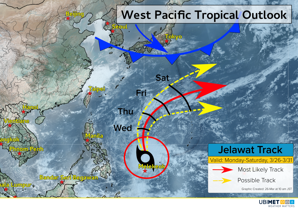
The storm will track northward through Wednesday, and then get steered toward the northeast thanks to a cold front moving southward from Japan.

The expected curve to the northeast will keep the center of Jelawat far from any major landmasses.
Later this week, east-facing coastal locations of the Philippians, Taiwan, northward to Japan should expected to see rough surf. Direct wind and rain impacts are not expected.
Will Jelawat Strengthen?
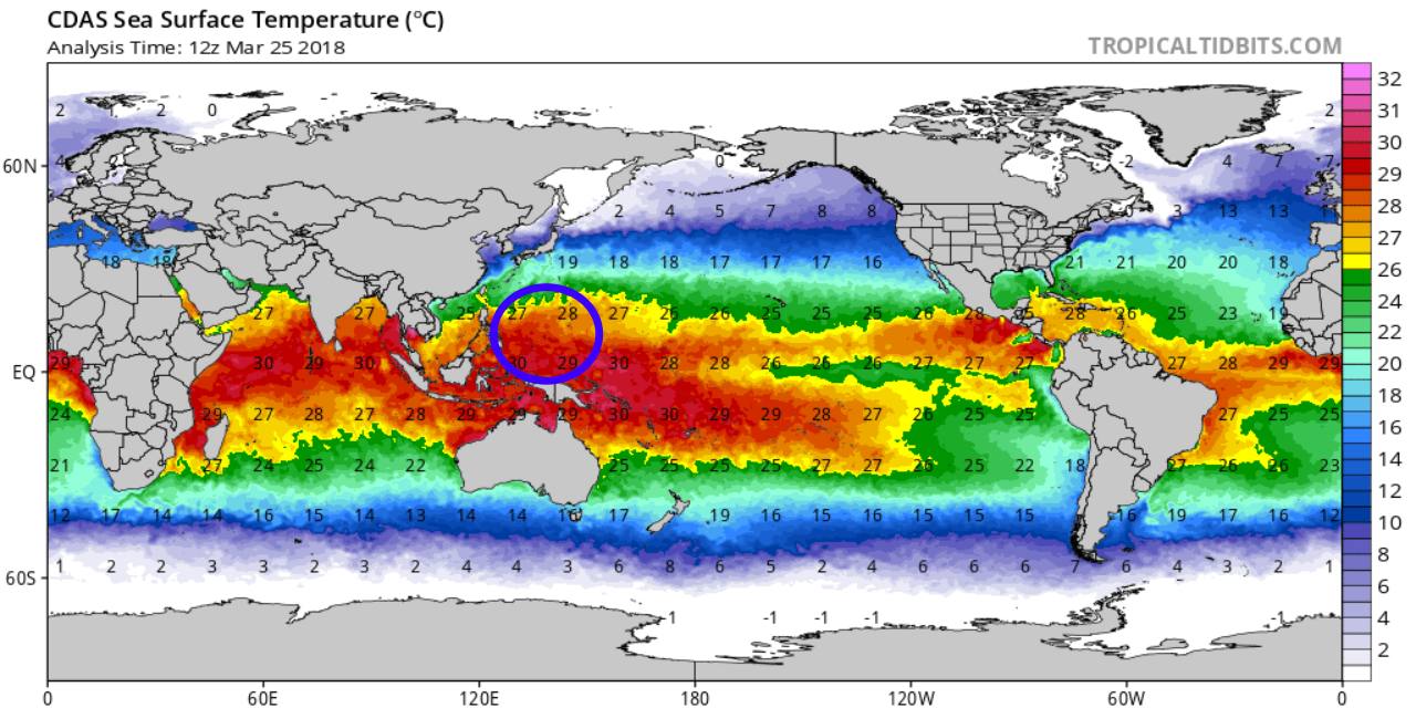
Warm ocean water temperatures of 27-29°C have allowed Jelawat to acquire tropical characteristics. However, as the cyclone continues northward it will encounter stronger westerly wind shear. The wind shear will have a negative effect on Jelawat, and weakening is expected beyond Wednesday.

Once the Jelawat turns toward the northeast, the cyclone is expected to lose its tropical characteristics as wind shear increases and sea-surface temperatures cool to below 25°C.
