Severe tropical cyclone Nora has intensified to Category Three status over the warm waters of the Gulf of Carpentaria. Nora is compact so conditions remain relatively tranquil along the coast as of late Saturday morning. However, conditions will deteriorate quickly later Saturday afternoon into the overnight, especially from Aurukun south. Nora is expected to turn south near the western coast of the Yorke Peninsula and slow down, possibly even stalling over the southeastern Gulf or the adjacent coast for a day or so!
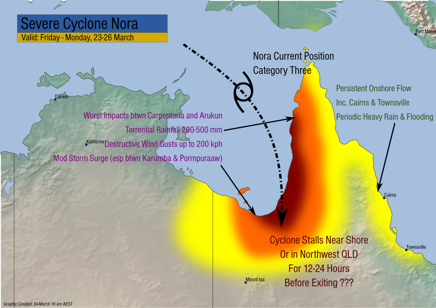
The heaviest impacts will fall on the coast from Aurukun down to Carpentaria. In this region, winds could gust up to 200 kph or more, leading to severe structural damage and widespread power outages. Rainfall up to 500 mm will also occur, leading to flash flooding. A moderate storm surge will affect the immediate coast, exacerbating any flooding issues.
Nora or its remnants will be slow to exit the region. Later next week, the circulation could move westward across NT and WA, producing locally heavy rain and gusty winds. We’ll have additional updates in the coming days!