
A few days of thundery rain are expected across east-central NSW beginning on Tuesday. Falls of greater 100 mm are likely in the areas of heaviest rain, leading to flooding concerns.
The Details
A stiff easterly wind will develop on Tuesday and draw moisture from the Pacific into the area.
Isolated showers and thunderstorms will during the midday hours and then become more widespread later in the afternoon and at night.
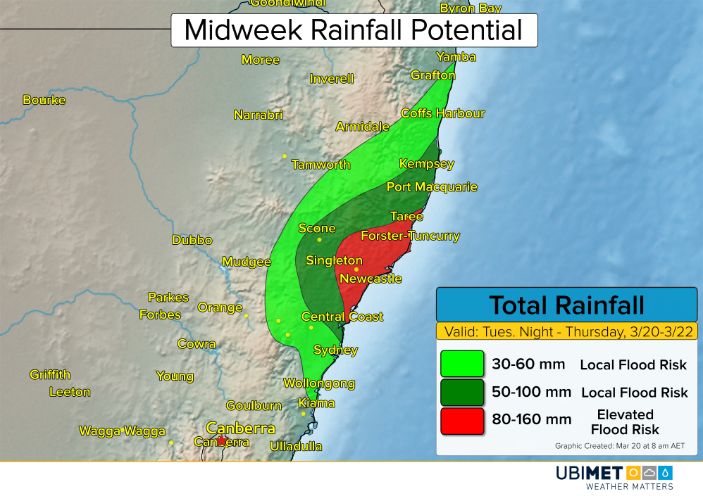
Waves of moderate to heavy thundery rain are expected from Tuesday night through Wednesday and into Thursday for some locations. The target for the heaviest rain is expected to be New Castle. It is within this area where widespread 3-day falls of 100 mm or more are possible.
Flash flooding is likely to occur in areas that receive greater than 100 mm of rain. Additionally, mudslides are possible in the hills.
The heaviest of the rain is expected to taper off later Thursday, but additional scattered thundery showers will continue across eastern NSW into Friday.