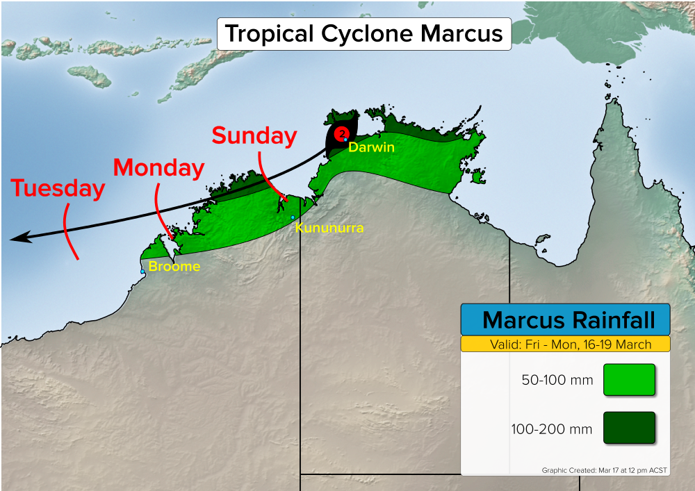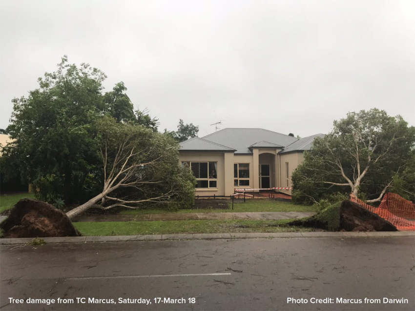
Tropical Cyclone Marcus battered northwest NT with damaging wind, heavy falls of rain, and coastal flooding on Saturday. The cyclone’s next destination is northern WA Sunday and Monday.
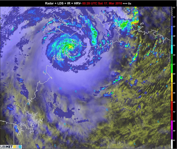
Marcus develop north of Tiwi Island on Friday, and then plowed through coastal northwest NT Saturday. Darwin took a direct hit from the cyclone as the center of the storm passed very close to the city.
Wind gusts in Darwin reached 122 kph (66 kts), while elsewhere gusts of 70-100 kph were common near the coast from Point Stuart to Dundee Beach.
Marcus Track and Future Impacts
As the cyclone moves over the very warm waters of the Joseph Bonaparte Gulf Saturday night into Sunday, models indicate that there is a window of opportunity for rapid intensification. Consequently, the cyclone could have more severe impacts on the north coast of WA.
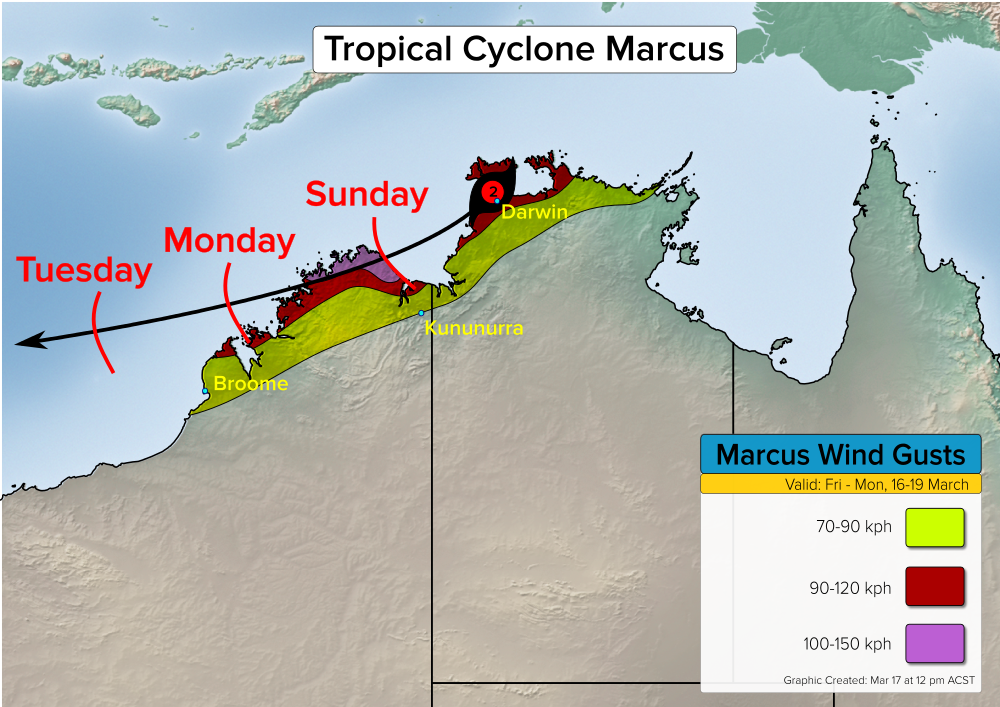
Coastal residents in northern WA should prepare for strong wind gusts exceeding 100 kph and heavy, flooding rainfall. The immediate coast of WA north of the Scambridge Gulf could additionally see some minor storm surge flooding.