A fairly strong storm system emerging over the High Plains tonight is producing a variety of weather hazards from winds and severe storms to heavy snow. It’s the latest in a pattern of active weather bridging record snowfall on both the West and East coasts.
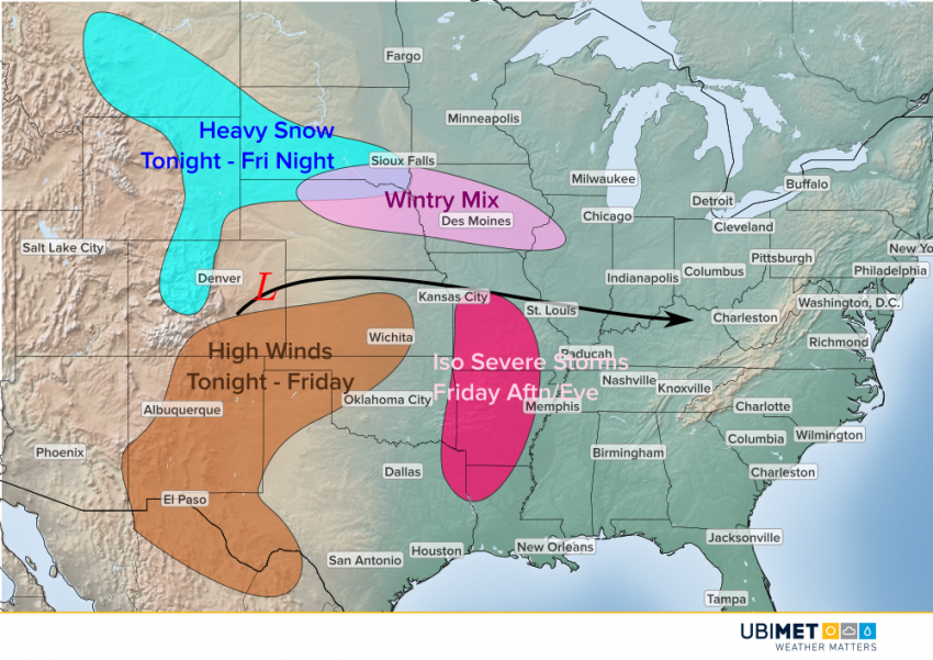
Snow has already broken out over the Rockies. These locally heavy snows will expand further north and eventually into parts of the Lower Plains, specifically near the South Dakota – Nebraska border. Accumulations up to 8-12 inches could occur, especially in the higher terrain. Further east into Iowa and northwestern Illinois, expect snow to mix with sleet and freezing rain with icing up to 0.25″ or more.
South of the track of the low pressure, expect gusty winds over the Southern High Plains, up to 60 mph in some wind prone locations. These high winds combined with the severe drought conditions in this region will lead to an extremely high wildfire danger through Friday.
By Friday afternoon, the system will move east and draw in some Gulf moisture. A few isolated severe storms could break out from the Texarkana area up through the Ozarks. The upper level dynamics will be sufficient for severe storms. The question mark that remains is how much moisture moves north and results in instability.