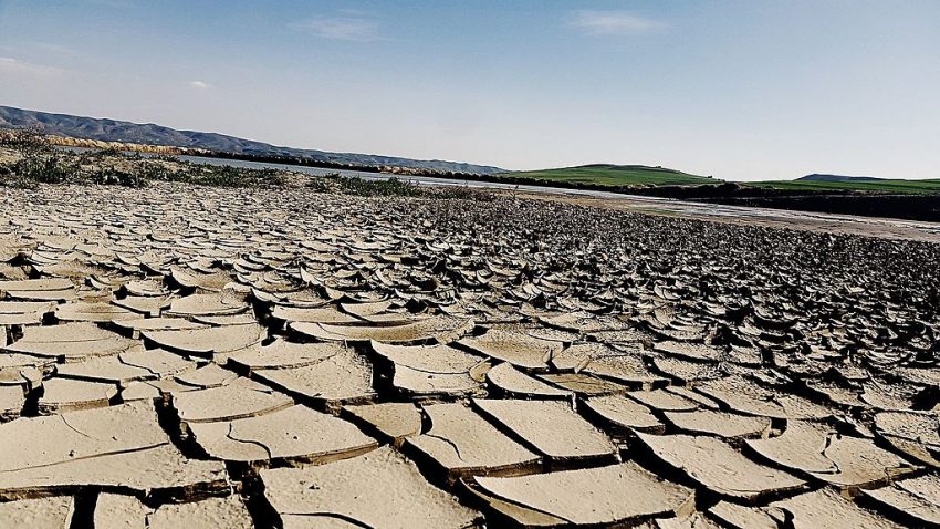
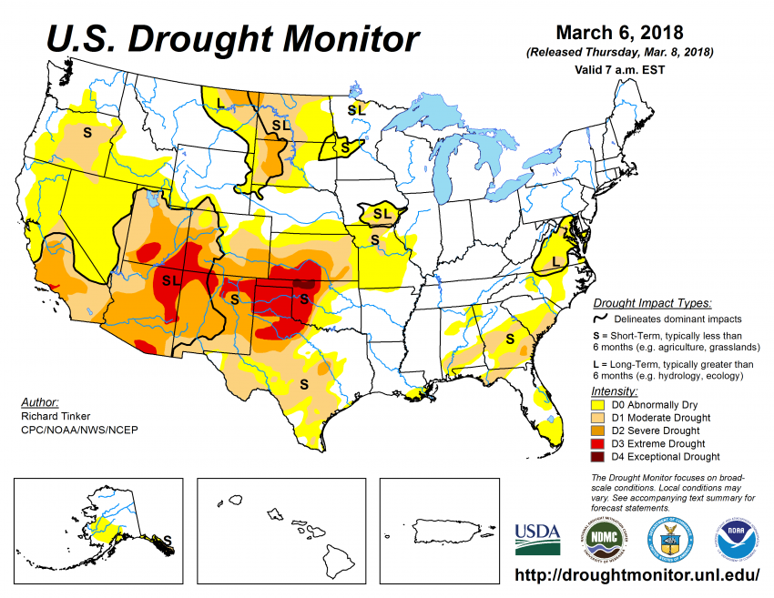
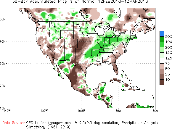
Major late-season winter storms hitting both coasts have been soaking up a lot of the headlines lately. But in the Plains, the story is quite the opposite. Months of below normal precipitation have led to rapidly deteriorating drought conditions (see below). Sections of the central High Plains have seen less than 10% of normal precipitation in the past month (see second image below). The official measuring station at Amarillo, Texas has recorded basically no significant precipitation since the first week of October! The Four Corners region as well as much of the Texas Panhandle, southwest Kansas, and western Oklahoma are facing extreme drought conditions. Some sections of northwest Oklahoma are even in the worst category, exceptional. In addition, quick-moving, relatively dry storm systems will result in periodic high winds and isolated thunderstorms through the next week or two. Wildfires become an extremely dangerous threat in this environment, and red flag warnings are in effect.
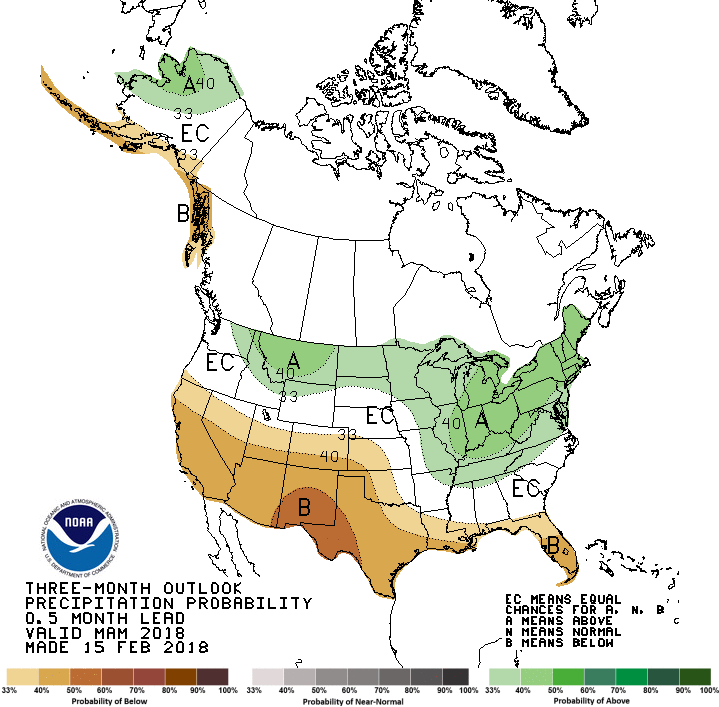
Unfortunately, the long-term outlook isn’t very favorable for increased precipitation (see below). The global weather patterns meteorologists use to make long-term forecasts are called teleconnections. These teleconnections indicate a fairly stagnant weather pattern, at least for the next few months. They would favor continued dry conditions in the High Plains, and across the southern tier in general. That’s especially bad news as we move closer to the prime growing season.