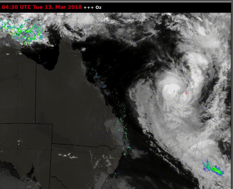
Tropical Cyclone Linda (see satellite image below) is moving close to coastal Queensland. Some gusty onshore winds are occurring over southeast sections, up to 70-80 kph on the Cape and outer islands. However, that’s about the extent of impacts as Linda is weakening rapidly and will eventually turn away from the mainland.
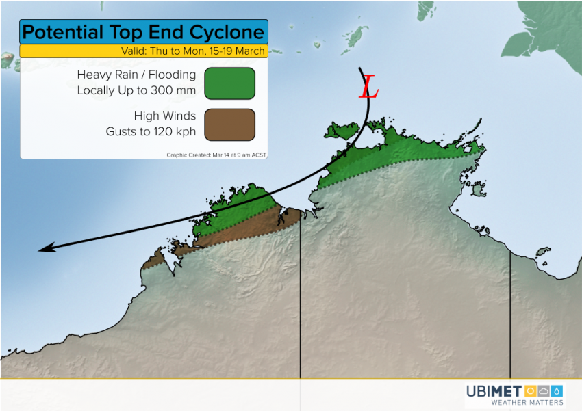
The next tropical threat we’re watching could target Northern Territory and Western Australia later this week. Model guidance has been pretty consistent signaling the development of a tropical low or cyclone in the Arafura Sea by Thursday or Friday. The system is likely to move south towards the north coast of Northern Territory before turning west and skirting Western Australia later this weekend or next week. Heavy rainfall and high winds would accompany any cyclone developing in this region. Rainfall amounts locally up to 300 mm will lead to serious flash flooding. Wind gusts to 120 kph could lead to scattered power outages and minor tree or structure damage.