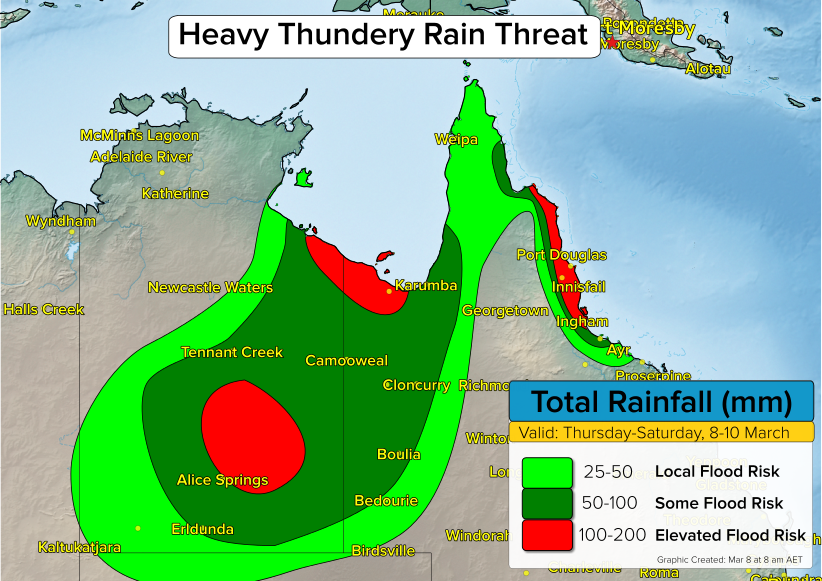
A slow moving disturbance will cross the Northern Territory bringing a heavy thundery rain threat to some normally drier regions in Central Australia.
What cities will be affected?
Cities such as Alice Springs, Tennant Creek, and Camooweal are expected to see rounds of thundery rain starting on Thursday and continuing into Saturday. 3-day rain totals in this area will average 50-100 mm, with some pockets of 100-200 mm of rain likely.
The expected rain falls will lead to a risk for flooding.
Who else will get rain?
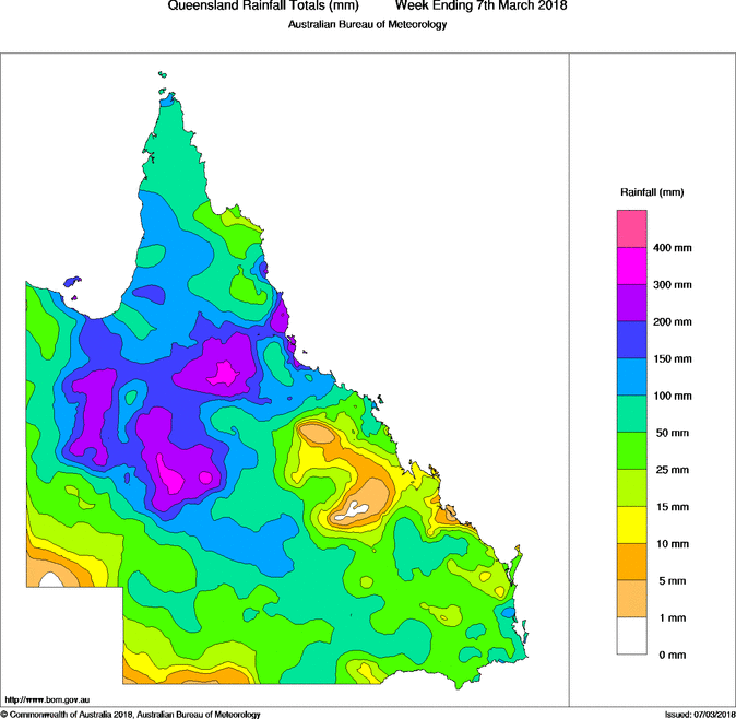
Farther to the east, additional rounds of thundery rain across central Queensland will add to the already impressive rain totals so far this March. Communities such as Mount Isa, Cloncurry, and Trepell have seen 100-300 mm of rain since March 1st.
The thundery rain across most of western Queensland will come to an end by Saturday as drier air pushes in from the east. This drier air will bring an end to the thundery rain threat in places like Alice Springs by Sunday.
A third area of heavier thundery rain will exist across the east coast of far northern Queensland from near Townsville to Cairns. The culprit for the rain here is a persistent onshore flow aided by a weak low pressure system over the Coral Sea. The greatest potential for heavy rain will be through Friday, before thundery showers become more sparse over the weekend.