On the heels of one of the worst winter storms in years, a second storm will target the Northeast with heavy snow, wind, and rain beginning Wednesday.
Colder air will be drawn closer to the coast with this storm, which will bring the likelihood for an impactful snow accumulation to parts of the coastal plain.
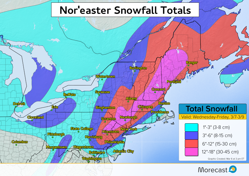
Parts of the I-95 corridor from Philadelphia to New York and Boston are likely to receive 3-6 inches of snow, with more than a foot likely in the northwest suburbs. The Jersey Shore and far southeast New England look to stay milder enough for mainly rain.
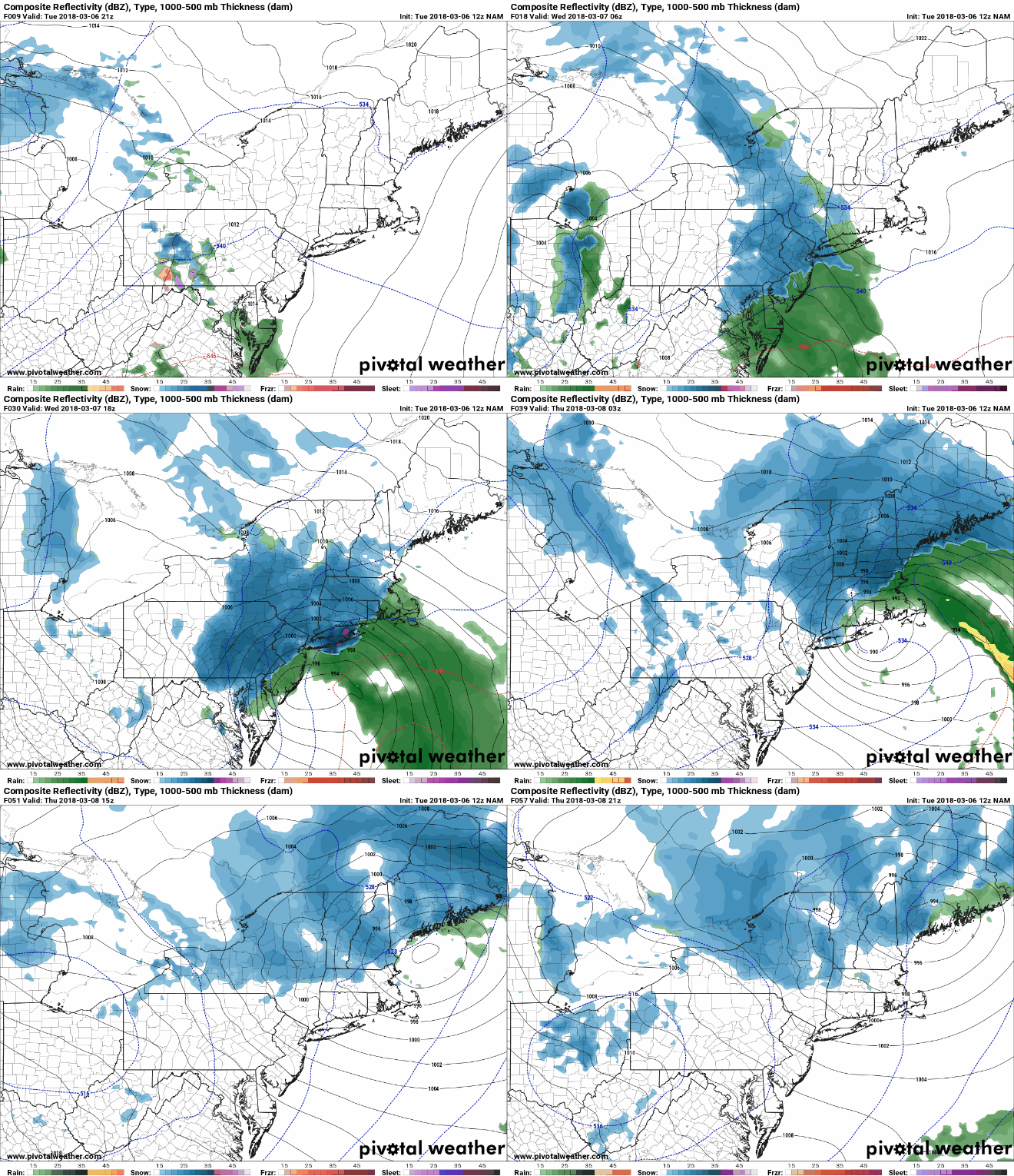
Model Simulation Of Nor’easter:
The Details:
A band of rain and snow is expected to push across the northern Mid-Atlantic through Wednesday morning. By midday Wednesday, low pressure will develop off the Mid-Atlantic coast and begin to enhance the precipitation across New Jersey, Pennsylvania and southern New York. Precipitation rates will increase as the low pressure strengthens and moves northeastward. The heavy precipitation will move into New England Wednesday afternoon and night. Where it is cold enough, snowfall rates of 1-3 inches per hour are likely, which will make travel difficult to near impossible at times.
Strong winds will also be factor, however, maximum wind gusts are not expected to be quite as strong as the previous storm last Friday. Still, the combination of strong winds and heavy wet snow will bring the risk of downing weaker tree branches and scattered power outages.
Coastal flooding will be a concern again for many east and northeast facing shorelines.
