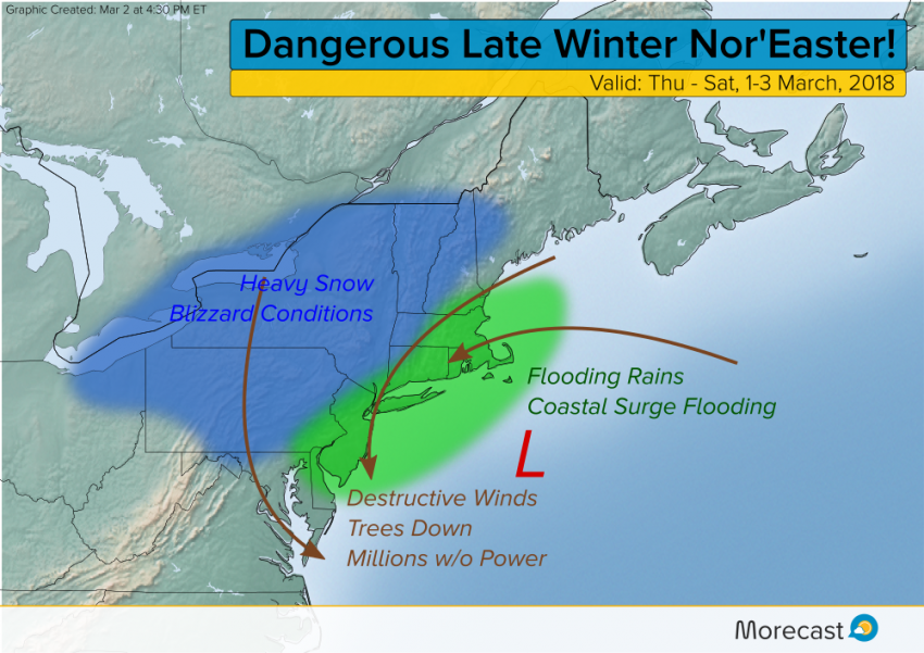
A powerful late-season winter storm spun up quickly off the U.S. Eastern Seaboard late Thursday into Friday, leading to heavy snows over the interior, flooding for the coast, and damaging winds throughout the region. The storm is still pounding portions of the Northeast as of Friday evening but here are a few of the impacts so far:
Highest Wind Gusts:
Washington, DC (Dulles): 67 mph (108 kph)
New York, NY (JFK): 63 mph (101 kph)
Providence, RI: 64 mph (103 kph)
Boston, MA: 60 mph (97 kph)
Millions have been reported without power thanks to fallen trees and power lines. Major bridges such as the Verrazano-Narrows Bridge in New York City have been forced to close. These strong east to northeast winds are also pushing sea water onshore, leading to major surge flooding, especially along the coast of Massachusetts. Very heavy rainfall of up to three inches is contributing to high water issues.
The major cities are just warm enough to be spared snow and ice accumulation. However, interior sections, especially the mountains, are seeing a crippling combination of winds and heavy, wet snow. Storm totals will likely exceed three feet in some areas with prolonged blizzard conditions. In the words of the National Weather Service, this is going to be “one to remember!” Rely on morecast.com and the Morecast app for the latest forecast details for your location!