We’ve entered a typical summertime pattern of severe storms in the Plains. Clusters of storms forming in the late afternoon join together to produce a squall line in the evening. These “mesoscale convective systems” or MCS’s can pose a major high wind threat, often well into the overnight hours.
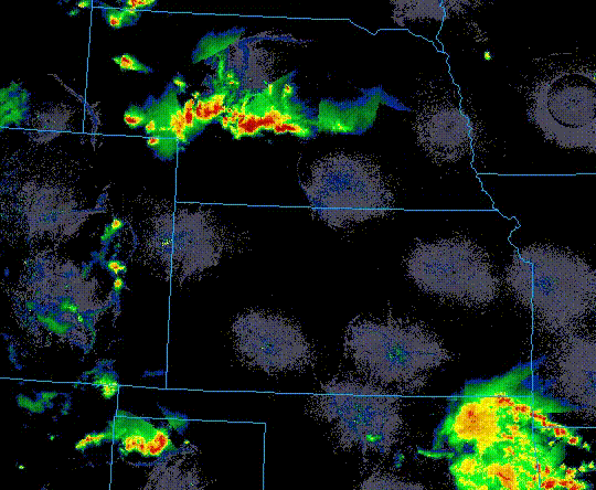
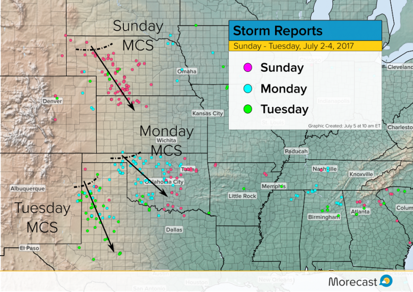
The above is a radar animation showing a squall line that formed in Nebraska before diving into Kansas on Sunday night. It produced numerous reports of wind gusts 65-75 mph between 9 pm and 1 am CT. That was the first night of three in a row (thus far) in which squall lines have affected the Plains (see below). Monday night’s storms mainly affected Oklahoma, while Tuesday’s storms rolled through the Texas panhandle.
These warm season Mesoscale Convective Systems (MCS) draw their fuel from the incredible energy built up during a hot summer day. They are usually guided by subtle surface boundaries and weak upper level disturbances. An upper level component sometimes isn’t necessary at all. Contrast that with the typical springtime severe outbreak, driven by strong upper level winds.
A particularly powerful, long-lasting MCS can achieve the designation of “derecho”. Derechos can pose the same potential for widespread destruction as a small hurricane. A derecho in 2012 that moved from Illinois to the Mid-Atlantic tallied more than $3 billion in damages while taking nearly two dozen lives.
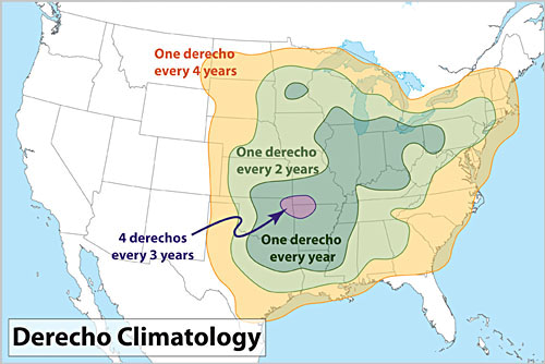
The Plains and Midwest are especially well-suited for MCS and derecho development (see graphic below, courtesy National Weather Service). Large amounts of heat and moisture are usually available in the summer. Additionally, the flat topography poses no obstacle to storm formation and organization. Indeed, these storm events are a vital component of the region’s water system. They contribute up to half the total warm season rainfall.
Recent advances in forecast model technology have dramatically increased the ability of meteorologists to predict these events. However, it remains the case that the subtle forces at work in these situations can bust forecasts in a major way. The fact that these storms tend to develop overnight adds to the danger potential.
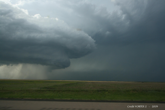
No MCS activity is expected today, but a severe squall line could affect the Upper Midwest on Thursday. The Morecast team will keep watching all summer long for potential severe storm development. Look for the latest information on our new website, Morecast.com, as well as our Twitter and Facebook pages! Lead photo credit: Sean Waugh w/NOAA’s National Severe Storms Laboratory (NSSL).