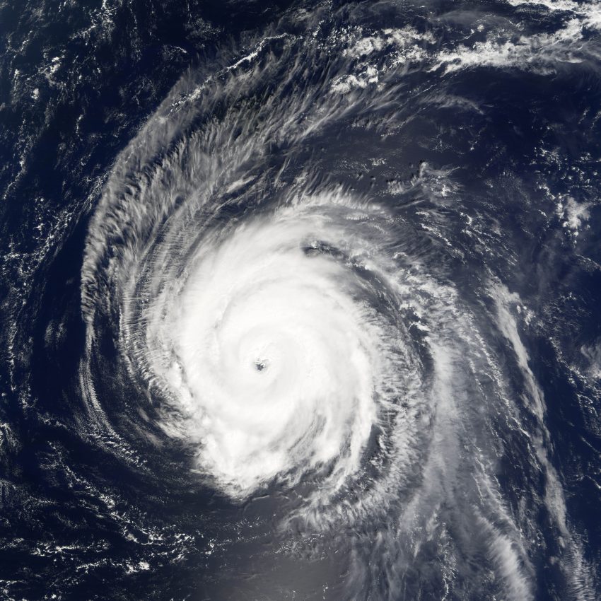
So far this year, the Atlantic Basin has been mostly quiet of tropical systems. As we head further into the month of July, the threat for tropical disturbances gradually increases as environmental conditions becomes more favorable.
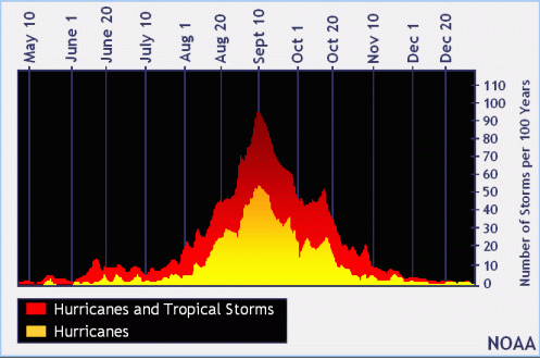
During the month of July, tropical activity starts out generally low for the amount of systems. Activity increases toward the end of the month, as a more favorable wind flow and warmer water temperatures occurs. According to graph, there have been roughly 30 hurricanes and tropical storms that have formed over a 100 year period (NOAA Tropical Cyclone, 2017).
Named storm formation location for July Atlantic TCs from 1851-2016. Gulf of Mexico, off US East Coast & near Antilles prime formation areas pic.twitter.com/3ZjcZasxIj
— Philip Klotzbach (@philklotzbach) July 3, 2017
Tweet above shows tropical disturbance origins during the month of July.
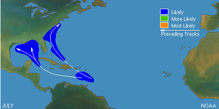
Once a disturbance forms, there are two distinctive tracks it could have during the month of July. If a low originates over the Lesser Antilles and moves west, it generally moves through the Caribbean into the Gulf of Mexico and could impact the Central Gulf Coast of the US. If the low tracks more north-northeast, it would most likely track up to near the Bahamas and swing between Bermuda and the Mid Atlantic coast of the US, or out to sea posing no threat to land. (NOAA Tropical Cyclone, 2017)
Forecast
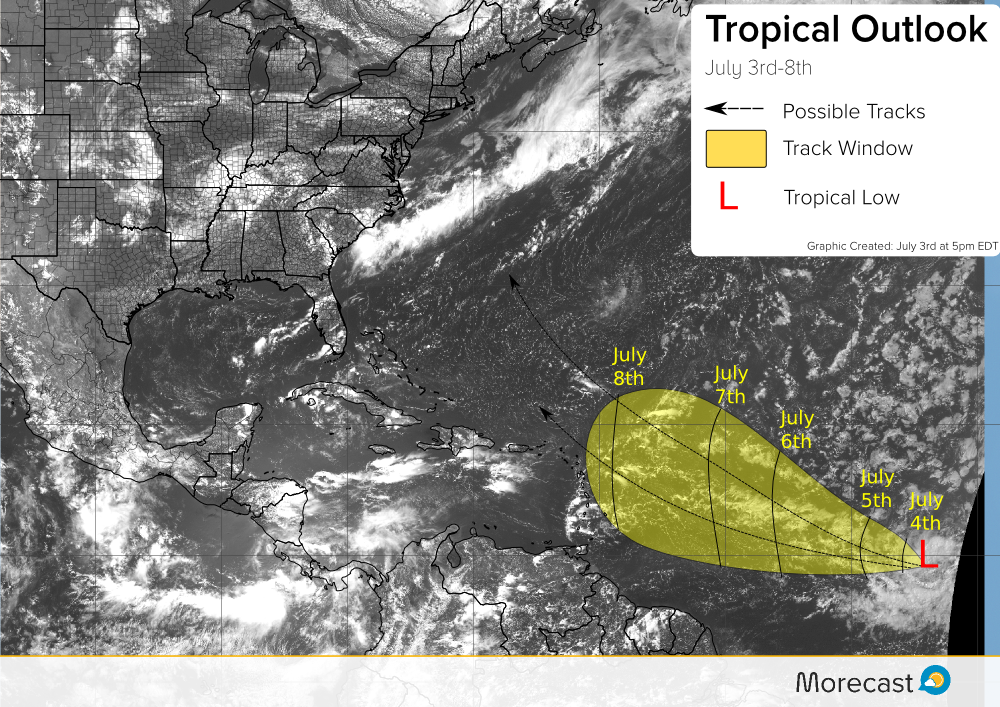
Satellite imagery from early this week shows a tropical disturbance well east of the Lesser Antilles. Forecasting models have come into better consensus that this tropical low could develop into a disturbance and move northeast of the Lesser Antilles and be near Bermuda by early next week. However, there is still some uncertainty as to how strong this low could develop as factors such as dry air and wind shear could keep the disturbance from deepening much at all.
Make sure to stay updated with Morecast for breaking news and interesting stories. We’ll update as necessary on Morecast.com, Twitter, and Facebook!
Sources:
A). Tropical Cyclone Climatology; National Hurricane Center; 3 July, 2017; <http://www.nhc.noaa.gov/climo/>