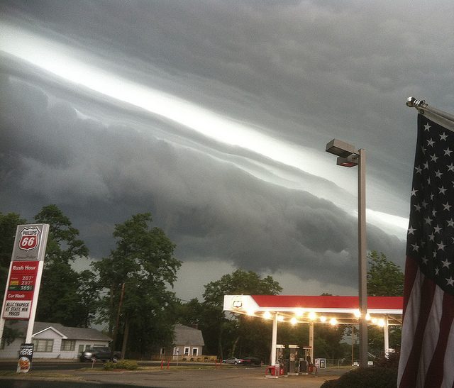
June 29th marks five years since one of the most destructive and well-publicized severe storm episodes in recent years. Termed a “derecho”, the squall line rolled from northern Indiana through the Mid-Atlantic with wind gusts exceeding 90 mph at times.
Record-breaking heat preceded the storms, as often happens with this type of event. Temperatures were in the mid-90s to low 100s across the Midwest and Mid-Atlantic. Washington, D.C. hit 104 degrees, the warmest temperature ever recorded there in the month of June. Dew points (a measure of moisture in the air) were well above normal in the upper 60s to lower 70s. It was plenty of high-octane fuel for storms to feed on.
Severe storms were already producing hail to three inches in diameter and wind gusts upwards of 60 mph across eastern Iowa and northern Illinois during the morning hours. After a brief period of relative calm around midday, a sudden gust to 91 mph at the Fort Wayne, Indiana airport announced the rebirth of the squall.
Over the next 12+ hours, reports were widespread of wind gusts 70-90 mph. Numerous large trees and power lines were downed, cars and trucks were flipped, and tractor trailers were toppled. High winds lifted a boat out of a lake and deposited it on a nearby road in Auglaize County, Ohio. Several million people lost power, many for several days, some even a week or more in rural areas. Here are some of the terrifying moments captured on video – beware of “colorful” expressions of amazement:
Ordinarily, storms weaken through the evening hours as instability decreases due to the loss of daytime heating. However, so much record heat and humidity built up during the day allowed the extreme instability to linger well into the overnight. Similarly, the Appalachian mountain chain typically disrupts or dissipates storm complexes approaching from the Midwest. However, this squall line was powerful enough to surge over the mountains. It re-intensified as it encountered warm, moist air in the Mid-Atlantic. It wasn’t until the storms reached the vast pool of cool maritime air over the Atlantic that they finally weakened.
These widespread winds led to dozens of injuries, some serious. The death toll reached 22 across seven states and the District of Columbia, mostly due to fallen trees or electrocutions from downed power lines. Many of the deaths occurred in northern Virginia. The storms struck there after dark, exacerbating the danger.
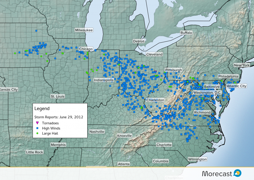
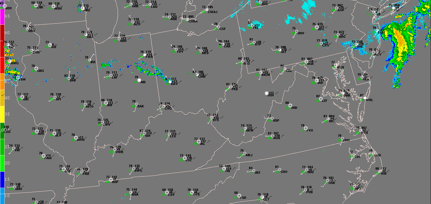
There was a densely-clustered corridor of damage reports, almost all destructive winds, from northern Indiana through the Mid-Atlantic (see above). It easily met the criteria to be classified as a derecho: a continuous swath at least 240 miles in length of severe wind reports > 58 mph or comparable damage. The event received widespread media attention, catapulting the word “derecho” to the public lexicon. As so often happens with suddenly famous, poorly understood scientific terms, “derecho” became the buzzword attached (in many cases inappropriately) to any noteworthy storms.
Morecast meteorologists are keeping an eye on typical trouble spots as we enter the mid- to late summer “derecho season”. Check back on Morecast.com and our Twitter or Facebook feeds for the latest updates!