
A stormy Thursday is expected in the Plains and the Mississippi Valley with damaging winds, hail, and a few tornadoes likely.
Severe Risk
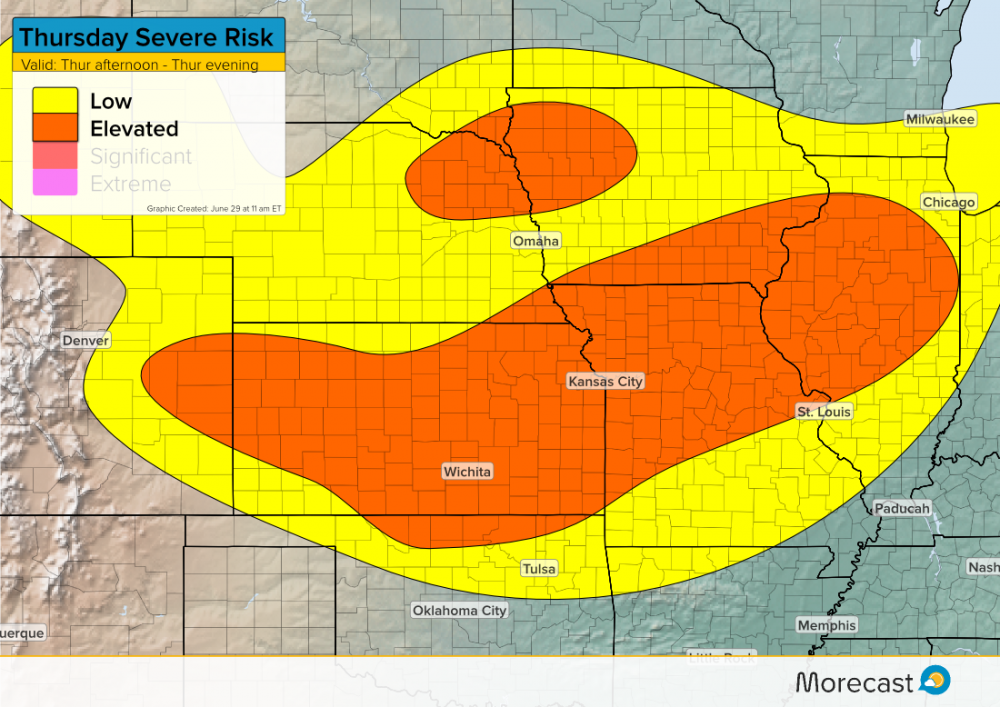
With a frontal boundary and an area of low pressure in the Plains, storms will have enough support to become severe late Thursday afternoon and continue into the evening. The strongest storms will stretch from Illinois to eastern Colorado. An elevated risk also exists further north for Iowa and Nebraska.
Wind shear will provide ingredients conducive for a few tornadoes, especially in portions of Missouri, Iowa, Nebraska, and eastern Colorado and Kansas.
The severe storms will begin in the late afternoon and move in an easterly direction into the evening hours.
Impacts
Similar to Wednesday’s storms, the primary concern with these storms will be strong wind gusts and hail. Winds will exceed 60 mph with the strongest cells and hail could be as large as baseball size. With a moist atmosphere, flash flooding could occur with the heaviest downpours. Although less likely, the potential for a few tornadoes does exist as well.
Residents in these regions should stay weather aware Thursday and pay attention to local watches and warnings.
For more updates, follow us on Twitter or Facebook and make sure to download the Morecast app.