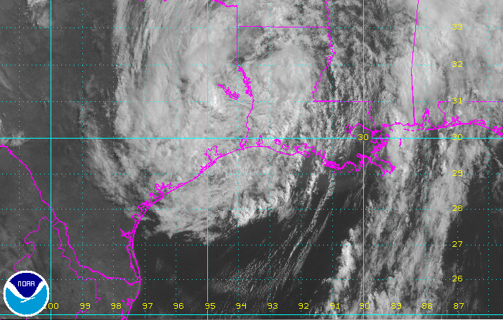
Cindy made landfall early Thursday morning between Port Arthur, Texas and Cameron, Louisiana. Despite weakening since landfall, the potential for life-threatening heavy rain and flooding will continue across the central Gulf Coast states through Thursday.
Cindy’s Impacts:
The greatest weather-related impact from Cindy will continue to be life-threatening flooding.
Through early Thursday, many communities along the central Gulf Coast have already picked up 5-10 inches of rain. Several areas from coastal Louisiana to the western Florida Panhandle have seen over 10 inches of rain.
72-hour rain totals ending at 8am CT this morning. Brighter blue shading represents totals >10 inches. #flwx #alwx #mswx #lawx pic.twitter.com/hByCFJlbYm
— Morecast USA (@Morecast_USA) June 22, 2017
Additional bands of tropical showers and occasional heavy thunderstorms will continue along the Gulf Coast into Thursday night. Travelers along the I-10 corridor from Beaumont to Pensacola–including New Orleans, Biloxi, Gulfport, and Mobile–should remain vigilant for flooded roadways due to the heavy rain.
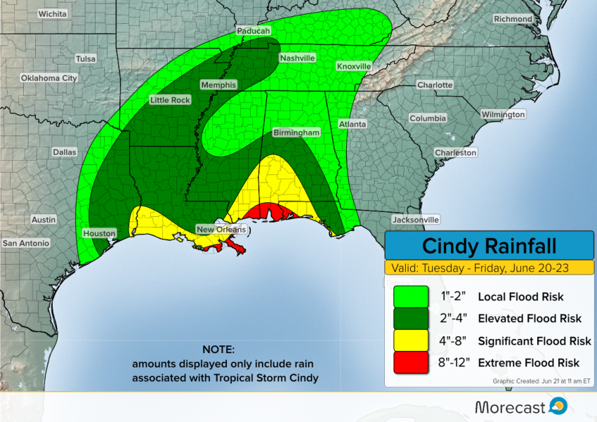
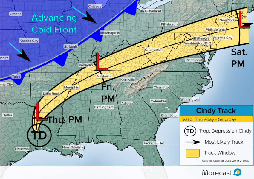
The heaviest rain will gradually diminish in coverage and intensity along the gulf coast Thursday night. On Friday, the heaviest rain will shift into the Mid-South closer to the center of circulation.
Cindy will degenerate into an area of low pressure as the system moves farther inland and begins to interact with a cold front. The front will pick up the storm and steer it northeastward to the Mid-Atlantic coast.
Cindy’s History
As Cindy approached the Gulf Coastline, oil rigs offshore on Wednesday experienced very rough conditions as the storm tracked northwestward.
This video may make you seasick. This is what it looks on an oil rig inside Tropical Storm Cindy. https://t.co/bhBZBlkjiv pic.twitter.com/2UaFHHya7a
— CNN Weather Center (@CNNweather) June 21, 2017
Morecast meteorologists will stay on top of the tropical threat this week. Keep an eye on our Facebook and Twitter as well as Morecast.com for the latest updates.