
A threat of severe storms continues in the East on Monday with damaging wind gusts and flash flooding expected.
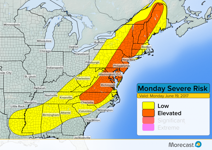
On Sunday, storms brought damaging winds and heavy downpours to the Midwest and Great Lakes. The same cold front responsible for the weekend severe weather continues its eastward progress Monday, with more severe storms possible. The threat area will generally cover most of New England and the Mid-Atlantic states, including the heavily traveled I-95 corridor.
A line of storms will become severe in the afternoon hours and will push east into the evening. Moving into late Monday/early Tuesday, most of the storms will move offshore, although a few storms may linger in southern states.
Hazards
Similar to the storms over the weekend, the main threats will again be damaging winds and flash flooding from heavy rain. Wind gusts are expected to exceed 60 mph with many of these cells, especially those in the Northeast and Delmarva regions.
Residents in the Northeast and Mid-Atlantic may have already noticed the muggy conditions if they live ahead of the cold front. That indicates there is a lot of moisture in the lower atmosphere, which will fuel the storms and lead to torrential downpours in some places, increasing the threat for flash flooding. The National Weather Service has issued a flash flood watch from Maine down into Maryland.
A low risk for brief, isolated tornadoes will also exist across eastern Pennsylvania, the Hudson Valley and western New England.