After severe storms pummeled parts of the Midwest and Great Plains on Saturday, the severe threat pushes into the eastern half of the country for Father’s Day Sunday.
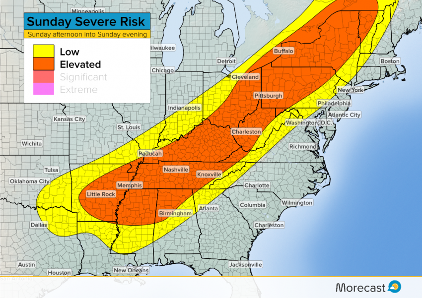
A cold front stretching from Ontario down into Texas provides the trigger mechanism for storm development Sunday. By the afternoon, clusters of storms with embedded severe cells will form ahead of the front and slice their way through parts of the Great Lakes, Ohio Valley and Mid-South. The storms will continue pushing east into central Pennsylvania and parts of northern New England during the evening hours.
Threats
The primary threat from Sunday’s storms will be damaging wind gusts over 60 mph. A few storms could also produce hail, especially in the Mid-South. The set-up is not favorable for widespread tornadoes, however, a couple spin ups can’t be ruled out in eastern Ontario and western Quebec along with parts of the eastern Great Lakes.
And you may have already noticed the muggy conditions if you live ahead of the cold front. That indicates there is a lot of moisture in the lower atmosphere, which will fuel the storms and lead to torrential downpours in some places, increasing the threat for flash flooding.
Looking Ahead
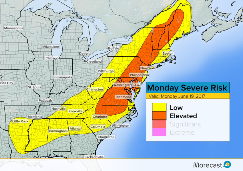
The cold front will continue its eastward progress Monday, with more severe storms possible. The threat area will generally cover most of New England and the Mid-Atlantic states, including the heavily traveled I-95 corridor. The main threats will again be damaging winds and flash flooding from heavy rain.
A low risk for brief, isolated tornadoes will also exist across eastern Pennsylvania, the Hudson Valley and western New England.