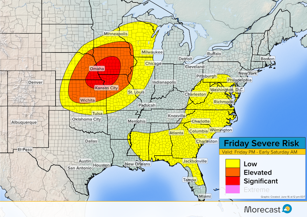
Synopsis:
After a round of severe weather impacted the Plains Thursday, some the same areas could be in for more Friday. A surface boundary currently positioned from western Minnesota down through eastern Colorado will slowly move east. Severe thunderstorms are likely to develop along this boundary from central Kansas up through southern Minnesota and push eastward. In the southeastern US, isolated severe storms are possible during the afternoon hours as daytime heating occurs.
Main Threats:
In the Plains and Upper Midwest, the biggest hazard will be large hail and damaging winds. Hail sizes could exceed 2 inches in diameter in some places and wind gusts could exceed 70 mph. Isolated tornadoes are not likely but cannot be ruled out. In the southeast, damaging winds remain a threat but the hail sizes should remain around an inch or less.
If severe weather strikes and conditions are safe, upload pictures to the Morecast app. Be sure to follow along with the Morecast team on our Facebook and Twitter pages for updates. For up to the minute forecasts at your exact location, be sure to visit our website.