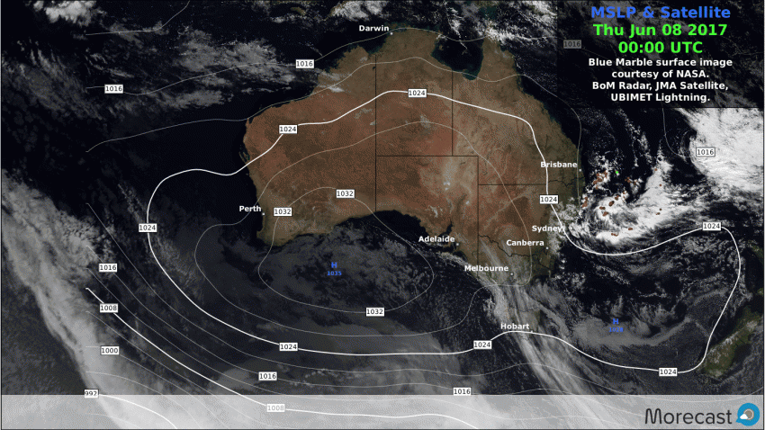
Perth is currently basking in it’s warmest start to winter on record. Though the area usually enjoys a relatively mild climate during the winter months with brief interludes of cooler period, it is the persistent nature of this particular balmy spell that makes it quite unique. A strong High pressure system in the Bight combined with frontal systems passing much further south then usual generated persistent north-easterly air stream across the region over the past week. These winds, dried and warmed by their passage across the vast arid interior resulted in clear bright days with well above average day time maximums for the time of year.
Present indications suggest that the current pattern is likely to remain in place for at least the next 7 days with the city predicted to see daily top temps reach the low twenties. All in all not a bad outcome for what is normally the chillier months of the Australian winter across the southern states.Thursday the 8th of June marks the 8th consecutive day that the the sunny Western Australian state capital has recorded maximum temperatures in excess of 22ºC. A balmy 4ºC above the long-term monthly average of 18ºC and a feat not experienced here in over 120 years of recorded observations.