
Snow is flying through the Central Rockies above 12,000 feet. As snow levels drop through tomorrow, watch for significant mountain snow and the major city of Denver to see a last winter wallop as we head towards summer!
Mountain Snow
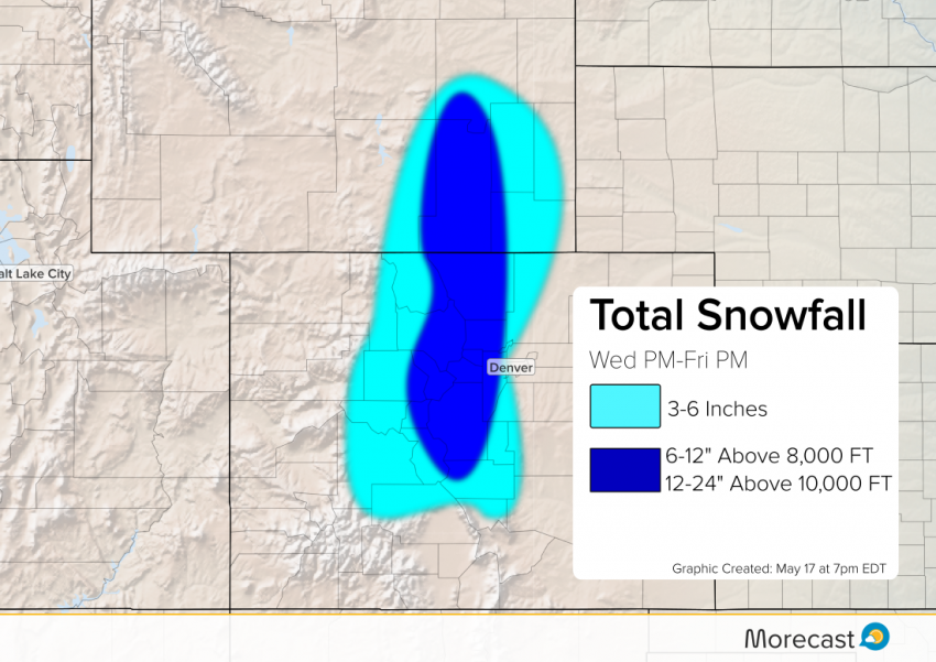
The freezing line is currently around 12,000 feet along the Continental Divide where flakes are beginning to fall. Through tonight and Thursday, snow levels will gradually drop to around 8,000 feet. Snow, heavy at times, will continue through the day Friday. One to two feet of snow is expected for mountain locations above 10,000 feet! Significant snow accumulations up to 1 foot will fall above 8,000 feet through Friday.
Denver, Colorado Snow
The Denver area will see liquid rain through the day Thursday. Through Thursday night and early Friday, temperatures will fall to the freezing mark and rain will transition to snow. Wet roads from the rain will make it difficult for snow to accumulate at the onset. Early Friday, however, the precipitation should be very heavy, allowing some snow to accumulate. Snow will most likely stick to grass and elevated surfaces. The highest amounts will occur on the western side of the city and foothills. Look for snow accumulations of 3-6 inches across this region.
Post your snow pictures to the community section of our Morecast app and check out morecast.com for your hometown forecast! Follow us on Facebook and Twitter!