We’ll see damaging wind for the Upper Midwest, and large hail for the Southern Plains from Monday afternoon into Tuesday morning.
Weather Recap
Storms in the Northern Plains kept rolling through sunrise and were still trekking east late on Monday morning. Isolated storms across northern Wisconsin and Minnesota also managed to produce plenty of lightning, but we saw no severe weather reports from those.
A very lightning active system of storms is pushing out of SD + NE towards the Upper Midwest. Damaging wind threat later today. #mnwx #iawx pic.twitter.com/Gjg1YYZ9pJ
— Morecast USA (@Morecast_USA) May 15, 2017
Forecast Breakdown
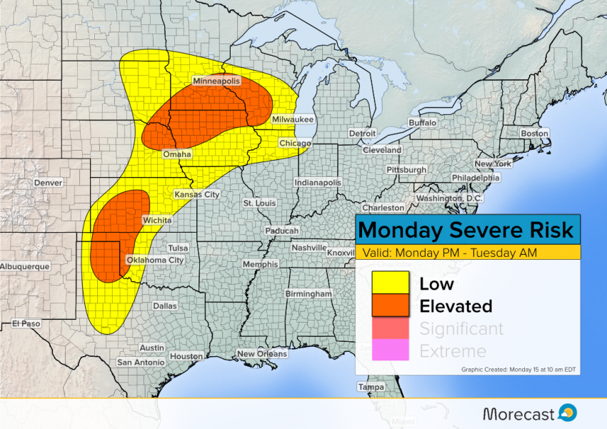
Upper Midwest: A system of storms will push into the region later on Monday and in the early hours of Tuesday. The system already resulted in isolated severe wind reports in South Dakota, with more expected in Minnesota, Iowa, and Wisconsin.
Damaging wind will be the greatest threat, though small hail and a couple of isolated, weaker-end tornado are possible.
Southern Plains: Scattered storms with some supercells along a dryline in western Oklahoma and Texas appear likely, though today’s tornado threat is negligible. Instead, large hail and strong wind will pose the greatest risk.
Storm activity will pop up in the late afternoon and evening, potentially carrying in the later hours in the day. Any potent cells should subside by midnight, however, though frequent lightning may continue into Tuesday.
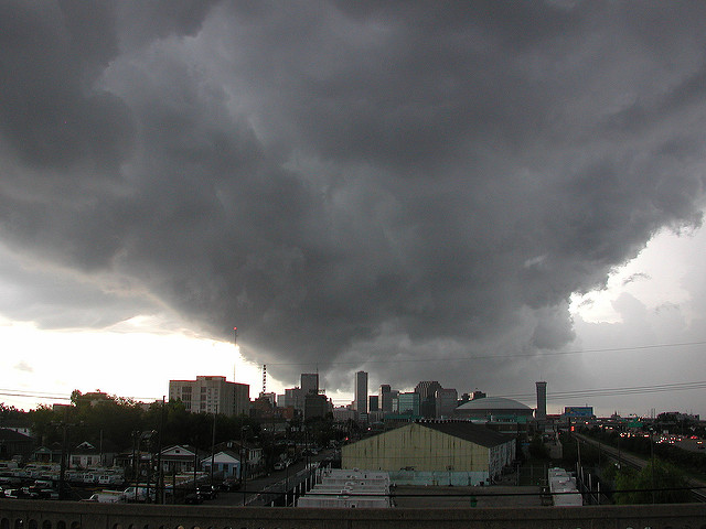
Head to our social media channels on Facebook and Twitter for the latest updates! Lead photo courtesy of flickr contributor Bart Everson.