We’re watching a few distinct focus areas for severe weather on Thursday, with wind, hail, and tornadoes all possible.
The Week So Far
Last Friday saw a round of very heavy rain push through the Northeast. New York City, a vulnerable target for flooding, saw plenty of the road network submerged.
Heavy #rain causing #flash flooding in #statenisland on Bay Street. #NYCwx #NYwx @spann @Morecast_USA @JaniceHuff4ny @ABC7NY #flooding pic.twitter.com/eKZgoGqSFZ
— Jebweather (@Jebweather) May 5, 2017
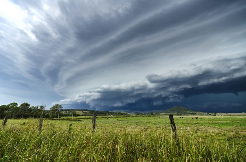
Some fairly low-key rounds of severe weather have also been quietly pushing across the Plains. Wednesday saw a potent supercell produce a textbook tornado. Storm chasers were on hand to catch the action.
#tornado earlier near Salem, Iowa #supercell #iawx @NWSQuadCities pic.twitter.com/VeuMStj2K5
— Jesse Risley (@Jesse_Risley) May 10, 2017
Thursday Severe Weather
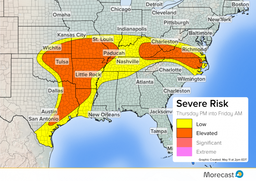
Texas
High humidity and some marginal conditions for supercells mean a risk for isolated, weaker tornadoes, damaging wind, and large hail. Storms popping in the afternoon will carry the greatest risk. Into the evening, storms will merge into a line, limiting the threat to wind.
Central Plains
Another day with large hail potential for Oklahoma, with the threat extending east into Missouri and Arkansas. Conditions in the late afternoon will support brief tornadoes.
NC, VA, KY
As the day heats up, growing storms will be able to tap favorable conditions for damaging winds and hail. Storms will initially fire up from remnants of last night’s activity across eastern Kentucky and West Virginia. This activity could well persist across the Appalachians, into Virginia and North Carolina this evening.
Stay on top of the day’s severe weather through our social media channels, on Facebook and Twitter.
What does the Mother’s Day weather have in store for you? We’ve got you covered with our special outlook.