The upcoming season has been analyzed by experts in forecasting Atlantic tropical activity.Generally the verdict is near normal numbers of tropical storms and hurricanes in 2017, a bit down from 2016. Forecasters will be carefully monitoring trends in two major factors, the ENSO and AMO, crucial to cyclone formation.
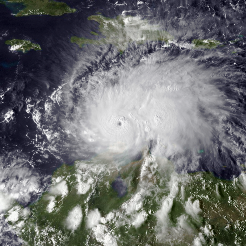
After a decade of fairly tranquil conditions with below normal tropical cyclone activity, there was a significant increase in 2016. Sixteen named storms developed in the Atlantic basin, including seven hurricanes. Alex formed in January, the first hurricane in that month since 1938. Several powerful storms slammed the Caribbean, including Category five monster Matthew (shown above), which killed hundreds in Haiti. Florida got in on the action, too, with both Matthew and Hermine making landfall as hurricanes.
The bump in cyclone activity was widely blamed on a rapid transition from strong El Niño to La Niña phases of the ENSO pattern. “ENSO” (El Niño-Southern Oscillation) refers to the cycle of warming and cooling of sea surface waters off the Pacific coast of South America. This cycle has been shown to have significant impacts on worldwide weather, including Atlantic tropical activity.
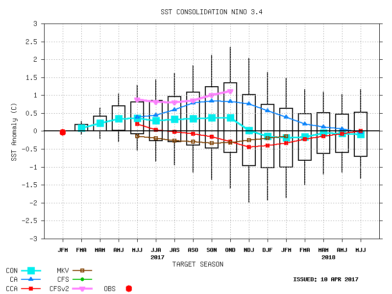
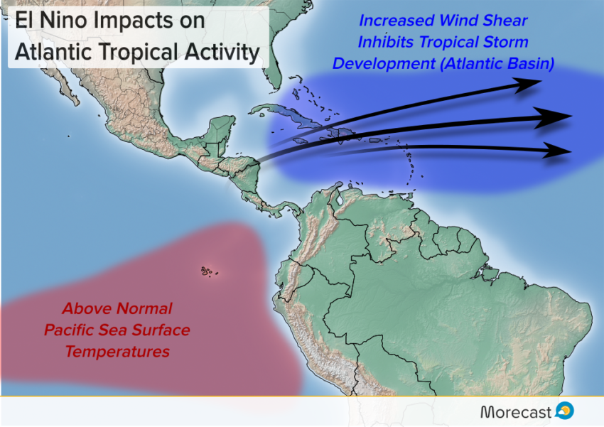
We’re currently in a neutral ENSO pattern. It’s not clear how the cycle will evolve through the summer and into the hurricane season. Some forecast models develop a mild El Niño (positive territory on the graphic above, courtesy CPC) while others leave it near neutral. An El Niño phase would increase wind shear in the upper levels over the Atlantic basin (diagram below). Wind shear acts to disrupt tropical storm development. Tropical cyclone numbers thus tend to be lower than average during El Niño years.
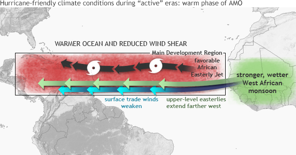
The other major factor is the AMO (Atlantic Multi-Decadal Oscillation), a pattern of fluctuation in Atlantic sea surface temperatures. The AMO acts on a longer time scale, say 10-20 years, as opposed to the yearly or even seasonal changes in ENSO. As you might expect, it’s the warm phase of the AMO that’s typically associated with increased cyclone activity (see below, courtesy NOAA). Open Atlantic water temps are currently running near normal, and are expected to remain so into the fall.
Agencies responsible for predicting seasonal hurricane activity have been generally forecasting a near-normal 2017. The near-normal AMO and neutral ENSO (perhaps weak El Niño) both suggest a somewhat less active season compared to 2016. However, coastal residents in the Caribbean, Central America, and the US can’t afford to let their guard down. One of the most powerful hurricanes ever to strike the US, Andrew in 1992, occurred during an otherwise quiet season.
We’ll be watching the tropics closely, ready to send updates whenever and wherever hurricanes threaten. Keep up with latest on our Twitter and Facebook feeds!