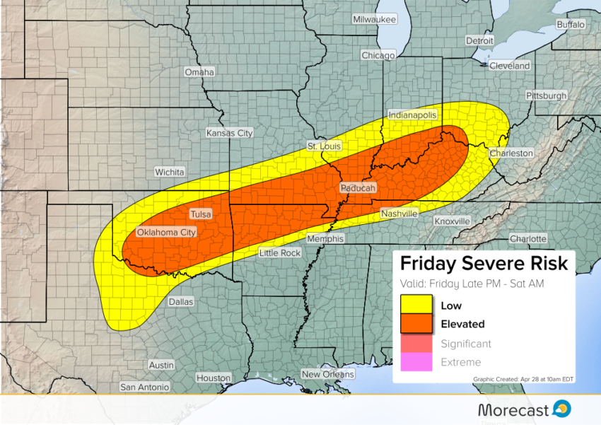
A surge of summer-like humidity will interact with a stationary front to produce strong to severe storms this afternoon. The main threat area will be a narrow zone from Oklahoma northeast through the Ohio Valley. Hotter cells in this zone will drop damaging winds and very large hail.
Temperatures will soar into the 80s and even 90s south of the front. Plenty of instability will build thanks to this warmth and Gulf moisture. Meanwhile, upper level winds will become more favorable for supporting severe storms later this afternoon.
However, the exact timing of these ingredients coming together is a question mark. At this time it appears the overall wind pattern will prevent a more robust severe event. However, damaging wind gusts to 65 mph and hail to two inches will still occur in some spots. An isolated tornado or two can’t be ruled out, either.
Storms will gradually weaken through Saturday morning, however flash flooding will become an increasing concern. This threat will persist over portions of the Plains through the weekend. Another round of severe could also threaten the Plains by later Saturday afternoon.
We’ll keep monitoring and issue updates as needed on Twitter and Facebook. Look for an outlook covering Saturday’s severe risk later today!