
TUESDAY UPDATE: A week-long active weather pattern from the Plains to the Southeast may mean the most widespread severe activity of the season so far.
Severe Weather Breakdown
2017 is already proving an active weather year. 485 confirmed tornadoes as of April 22nd is almost record breaking pace and includes 11 EF3 or stronger twisters.
With severe weather potential in the Plains this week, here’s how 2017’s tornado numbers are stacking up. Well above average so far. pic.twitter.com/5CpDieLo4l
— Morecast USA (@Morecast_USA) April 24, 2017
Despite high numbers, it’s actually been a slow year for the Plains so far, with most of the tornadic activity concentrated in the Southeast. We could see that change this coming week
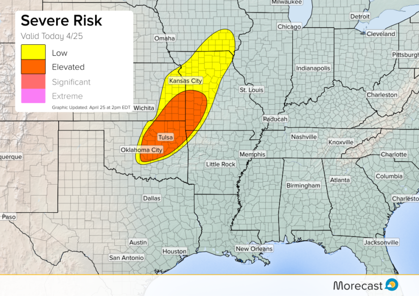
Today kicks off with the first in a procession of systems. A surface front draped from the Mississippi Valley through the Southern Plains will be the focal point for storm development, with northeast OK and southeast KS primed to see large hail, high winds, and perhaps a tornado!
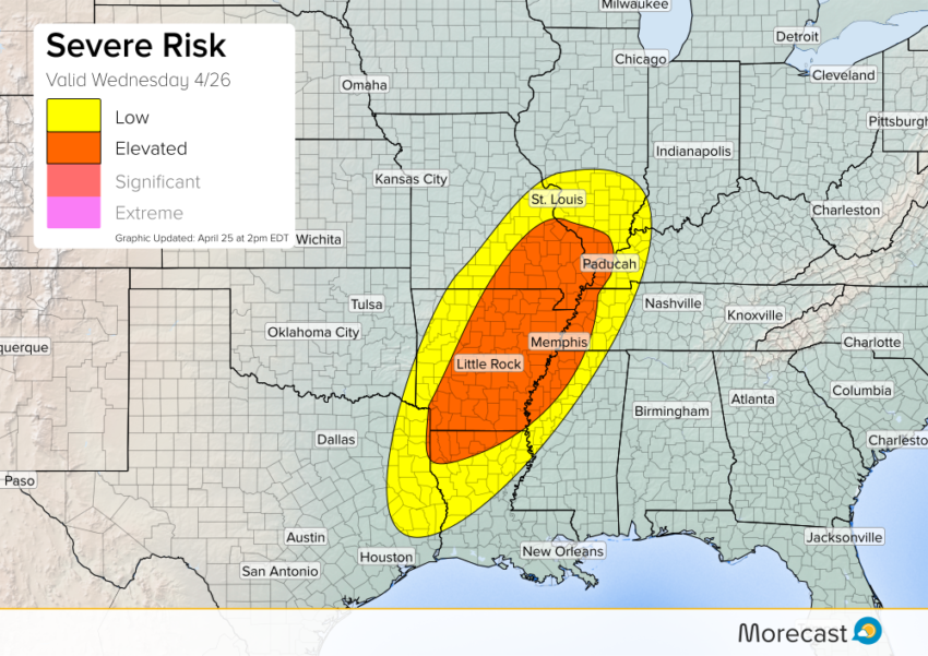
On Wednesday, this same surface front will trek eastward into the Central and Lower Mississippi Valley region. Favorable, upper-level dynamics will move in from the west, allowing more widespread severe weather. Supercells will be capable of producing tornadoes and large hail.
Storms will mostly merge into a line through the evening, transitioning the main threat to straight-line damaging winds.
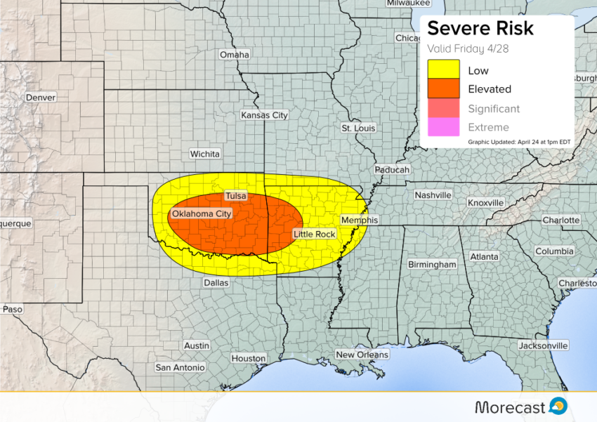
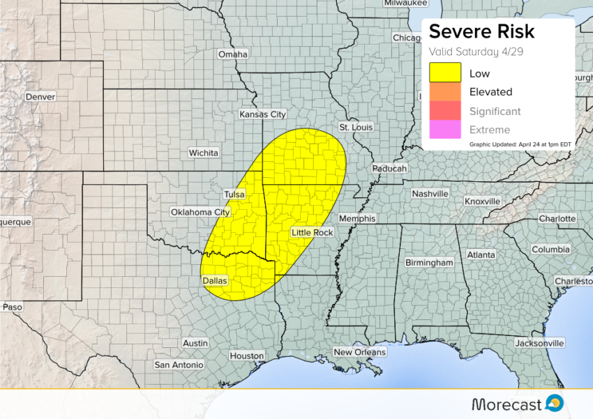
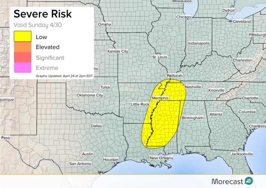
The most potent storms of the week could well be Friday and through the weekend, but uncertainty remains. As it stands, tornadic supercells across Oklahoma is the going scenario for Friday. As the late week system progresses, the threat will shift east. Arkansas and Missouri would see activity on Saturday, then Mississippi and Tennessee on Sunday.
Friday:
Saturday:
Sunday:
As always, we’ll be keeping an eye on the situation. You can access our latest updates via Twitter and Facebook, or use the scrolling ticker on your Morecast app.